Showing posts with label China. Show all posts

Sunday, 24 April 2011

Western China

China’s westernmost province is ethnically, culturally and linguistically unlike anywhere else we’ve visited in the country. Named Xinjiang, or “new frontier” by the Chinese, and traditionally known as East Turkestan in the West, the region was under Chinese control between the First Century BC and the Ninth Century AD but was then ruled separately from the rest of China (and either independent or under Mongol rule) for over a thousand years, and still feels very separate from the rest of China.

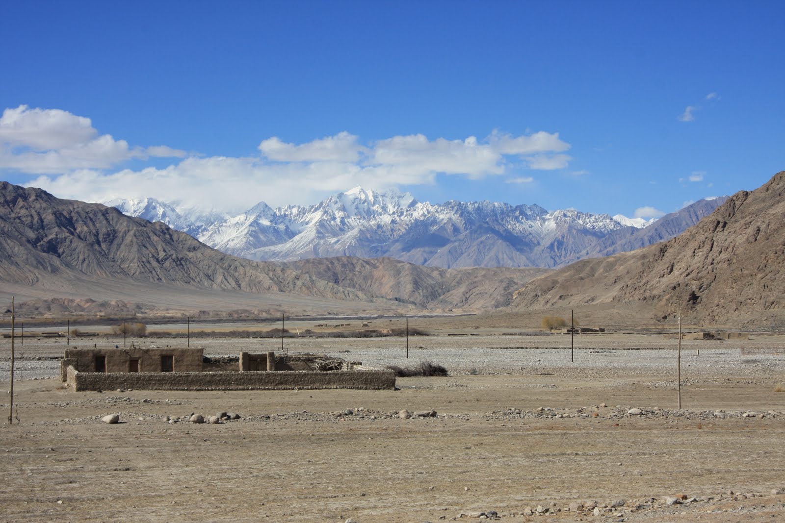
Getting off the train from Xian, and throughout our time in Xinjiang, we had to keep reminding ourselves we were still in China, so different does it feel to the rest of the country. The landscape is dry and desert-like and very unlike the lush fertile east; the older buildings tend to be single storey and built of mud bricks while the newer ones are built in Arabian rather than Chinese style; the local Uighur language sounds guttural and entirely different from Chinese, and there’s relatively little Chinese script visible too, with Uighur instead written using a modified Arabic script; the music sounds Turkish or Middle Eastern; the food is different; and above all the people look and dress very differently.


In Xinjiang noodles and flat breads (called naan) rather than rice are the staple foods. Both are delicious, the bread topped with sesame or poppy seeds and the noodles pulled by hand into long threads and served with spicy sauces of tomatoes, onions, peppers and mutton. The streets are filled with the smells of bread cooking in outdoor tandoor ovens, and of burning charcoal and grilled mutton rising from the road-side kebab stalls. The tea is different too – it’s still predominantly green tea that’s served but which is flavoured with rose petals or spices and served in bowls rather than cups.


The local population is predominantly Uighur (a people of Turkic origin), with a mix of ethnic Tajiks, Kyrgyz and Kazaks as well, and facially people look Central Asian rather than Chinese. Both men and women tend to dress relatively conservatively, the men in dark suits and the women in drab coloured long skirts and coats with covered heads (often the headscarves are the one flash of colour in their outfits). Here for the first time in China we saw women with covered faces too, but wearing not delicate veils or even burkhas but thick brown cloths just draped over their faces like a tea towel. The men too cover their heads with hats of varying styles, with flat caps and diamond-shaped green embroidered hats the most popular. Under their hats most of the older men have shaved or short cropped hair but sport long flowing beards (with shaved upper lips), while the younger and middle-aged men tend to have moustaches but no beards.

Despite their outwardly conservative appearance however we found the Uighurs overwhelmingly and immediately friendly and hospitable, in contrast to the majority of the Han Chinese we’d met elsewhere in China. Almost everywhere we were greeted with warmth, kindness and curiosity, with people intrigued as to who we were, where we were from and what had brought us to their province and keen to welcome us. Surprisingly too although the region sees far fewer tourists than other parts of China, we met far more people in Xinjiang who could or chose to talk to us in English. Sadly though, as in Tibet, several of the Uighurs we spoke to told us of how their culture and religion are being repressed and of how they face discrimination even in their homeland with the best jobs reserved for influx of Han Chinese the Government are attracting to the region with generous tax breaks.


We broke our journey from Xian to the West of Xinjiang in a small town called Turpan, famous in China for being both the lowest place in the country (at 154 metres below sea level) and the hottest (with a highest recorded temperature of 49.6 degrees), as well as being pretty much the furthest place in the world from the sea. Thankfully it wasn’t too hot when we were there and we spent an interesting and enjoyable day exploring a traditional mud-brick built Uighur village in the desert, the ruins of a 14th Century Han Garrison city, and Turpan’s sprawling bazaar.


From Turpan we travelled on to Kashgar, a town of narrow lanes and small ornate mosques in the far west of the province which is famous for holding one of the largest animal markets in Central Asia. From early morning, the market place filled up steadily with livestock and men: bulls, sheep, donkeys, and even a few dogs, cats and horses were hustled off carts and trucks and tethered to the dusty ground, while groups of men mingled around them. Later we visited another, even more chaotic market in a neighbouring small town where alongside the animals we’d seen traded in Kashgar was a surprisingly large camel market, complete with babies as well as adult camels –apparently a healthy adult camel sells for around £1000.


From Kashgar we spent a few days travelling south along the Karakorum Highway which cuts through the Pamirs and Karakorum mountain ranges to connect Kashgar and Islamabad. The road runs through high, desert like country, at times cutting through deep and narrow gorges, and at others crossing wide open boulder strewn plains and passing enormous frozen lakes. At all times the mountains dominated the views, their lower sections an amazing array of soft pastel colours with thick snow and ice above.


We spent two days in Tashkurgan, a small Tajik town close to the Tajikistan, Pakistan and Afghanistan borders, going for walks out across the plains, past shepherds and their huge flocks of sheep. Here we saw few cars, with most families owning a donkey and cart which forms their main form of transport. At a small village nestled at the foot of the hills a couple invited us into their home and served us bread and tea, humbling us with their generous hospitality. Lacking any shared language we communicated through mime and played with their two year old twins who soon got over their shock at having two odd looking strangers in their house. Their home was immaculately neat and tidy but almost entirely lacking in possessions: in the main room where we ate there were just a small stove, a foot-powered sewing machine and a collection of rugs and blankets. Amazingly, most of the people in the village seemed to speak not only no Chinese, but also no Uighur (the predominant language of the region), only Tajik, giving an indication of how localised their worlds must be. As in Mongolia, the sheer scale of the landscape with its wide open spaces and bright blue skies was incredible, and its colours and beauty wonderfully restorative.


Before leaving China we spent two days camel riding and camping out in the vast Taklamakan Desert, one of the largest sandy deserts in the world which covers an area of 270,000 square kilometres and was recently crossed on foot for the first time in 72 days. Although we ventured only a short way into the desert we soon felt disorientated and lost in the midst of high, shifting sand-dunes that stretched to the horizon with – to our eyes – no discernable landmarks. As elsewhere in Xinjiang we were struck by the vastness of the landscape and by the quiet that engulfs it: we saw no other people nor any sign of them while we were in the desert, there are no settlements there, and just a handful of wandering shepherds and occasional tourists, and a sense of great emptiness.


Just being in the desert was a wonderful experience, while the camel riding itself was also hugely enjoyable, with the motion of the animals similar to being on a gently rocking boat and familiar to us from our camel riding in Mongolia. Where that had been on flat stable ground however this time the animals had to clamber up and down unstable sand-dunes that looked just like the deserts of our imaginations.

Our ten days in Xinjiang have been a highlight of all of our time in China. Yet we would probably never have come to this beautiful and fascinating area if we hadn’t intended to travel on into Central Asia. It is an area about which remains relatively unknown in the West and of which we were largely ignorant before researching our route: though it occupies a sixth of China’s landmass it receives few foreign tourists, rarely features in the media and the chapter on Xinjiang was one of the shortest in our guidebook. Yet it is one of the most interesting, varied and beautiful places we’ve visited not just in China but anywhere and deserves to be considered as a destination in its own right.

Xian

Our first stop back in China was Xi’an, once one of the country’s four great ancient capitals. Xi'an became a cultural and political centre of China in the 11th Century BC with the founding of the Zhou Dynasty but it is perhaps best known as the capital of the first emperor of China, Qin Shi Huang, who unified China for the first time in the 3rd Century BC and after whom the country may have been named.

Like surely all other foreign visitors to Xi’an we made the pilgrimage to visit Emperor Qin Shi Huang’s vast army of Terracotta Warriors, which date from around 210 BC but were only discovered in their subterranean hiding place in 1974. The combination of the sheer number of warriors – the three pits so far excavated contain an estimated over 8,000 soldiers, 130 chariots with 520 horses and 150 cavalry horses – and the level of detail in their decoration is amazing. Not only are no two faces among the soldiers the same, but their clothes, hair and armour are all subtly different too, and all beautifully crafted. It is an awesome sight to look down on this vast army of life-size soldiers marching in neat lines in their sunken pits. Sadly however the curation of the museum is poor: visitors are kept well away from all bar five of the warriors, and many of the remainder are hard to see clearly in poorly lit pits. Even more disappointingly there were perhaps just 200 – 300 words of text in the entire complex about the Warriors and their history. Rather than informing visitors, effort seemed instead to have been devoted to profiting from them and we were confronted with countless opportunities to buy replica warriors of all sizes, to be photographed in front of other replicas, or even to have a personalised warrior made in our likeness – all for a fee of course.


As well as visiting the Warriors we visited the fascinating tomb of Emperor Jingdi, an Emperor in the Han Dynasty from 156 BC to 141 BC. Like Emperor Qin Shi Huang, Emperor Jingdi chose to be buried surrounded by terracotta figures, but Jingdi’s are much smaller than lifesize and there are few soldiers amongst the figures. Instead they provide an insight into everyday life, with groups of men, women, children, eunuchs and even hundreds of wonderfully lifelike sheep, goats, pigs, dogs and horses.

Xi’an – then known as Changan – also served as an imperial capital for later emperors from the 7th Century AD. A 9 mile city wall which was constructed in 1370 during the Ming Dynasty (1368 to 1644) survived the Cultural Revolution and remains intact to this day, and we spent an enjoyable few hours walking its length as the sun set over the city.


Other than the wall however not much remains of the city’s rich history. The historic Bell Tower at the heart of the city has been turned into a traffic island, accessible only via an underpass, and shares centre stage with an enormous shopping mall and an enormous and gleaming McDonalds. Arriving from Kathmandu this modernity was shocking but not altogether unwelcome: the clean, well-lit and wide, straight roads in such contrast to the over-crowded dark litter strewn alleys of Nepal’s capital, and the reliable hot running water and 24 hour electricity felt luxurious indeed.

As Xi’an was the Eastern terminus of the Silk Road it also seemed a fitting place for us to begin our journey home. Although the name, the Silk Road, wasn’t coined until 19th Century, goods have been traded overland between China and Europe since 1000BC, along the shifting network of overland trading routes that made up the various Silk Roads. We hope to travel some of those old trading routes, visiting parts of Western China, Central Asia, the Caucuses and Turkey, on our way.

Wednesday, 22 December 2010

Tibet - Lhasa and Everest Base Camp

We’ve both been long fascinated by Tibet and its history, and so the idea of coming here had been one of the parts of our trip we were most looking forward to. Because of the political situation, foreigners need multiple permits just to enter the region, have to be accompanied by a guide to visit any site of interest and at all times outside Lhasa, and are banned from most areas. Yet these restrictions didn’t lessen our enjoyment of Tibet, and our time there proved to be everything we’d hoped it would be and a real highlight of our trip so far.

We’d originally hoped to be able to travel directly to Lhasa from northern Yunnan, where we’d been to hike Tiger Leaping Gorge and which is on the border of Tibet, but instead – with eastern Tibet closed to foreigners – we embarked on a 4 day, 5000km journey involving 3 trains and a stop-over in Chengdu just long enough to visit the Giant Pandas and the tiny panda cubs at the breeding research centre. Reluctantly, when returning to Yunnan we chose to fly rather than repeat the overland journey and so took our first flight since we arrived in Bergen, 15,000 miles ago. Amazingly, a journey that had taken over 60 hours by train took less than 6 hours in the air.

We spent four days in and around the capital Lhasa, exploring the old part of town and visiting several monasteries and temples, as well as the fabulous maroon and white Potala Palace. The Potala was the traditional seat of political and religious authority in Tibet, which stands on a hill in the centre of the city and is its focal point. After the hustle and bustle of most Chinese cities, Lhasa felt delightfully small and quiet (there are just 800,000 inhabitants) and was a fabulous city to wander on foot. And while visiting in winter meant enduing cold weather (typically between -10 and 8 degrees in Lhasa and a lot colder outside the city), it also meant we enjoyed clear blue skies everyday and got to see the region at a time when there are almost no foreign or Chinese tourists around and instead Lhasa is filled with pilgrims from across the country, and we spent hours just people watching.


Although a part of the People’s Republic of China since 1950, Tibet feels like a separate country. Tibetans tend to be taller and look very different from the Han Chinese, with wide, high cheekbones, and darker skin; they dress differently too, the men in thick fleece lined cloaks worn off one shoulder and with knee length sleeves, their hair often long and sometimes plaited or topped with cowboy style hats; the women in dark skirts and striped aprons, with coloured thread or coral and turquoise beads woven into their hair, often – incongruously – with a North Face jacket over the top; and they speak an entirely different language. They were also some of the smiliest people either of us had ever seen and everywhere we went we were greeted with a grin or tashi delek (hello).


The signs of Chinese control however are obvious: Chinese riot police patrol the streets and sit up on the tops of the buildings pointing video cameras and guns down at the people below; a Chinese flag flies the Potala Palace and from every public building; and the Tibetan flag and images of the Dalai Lama are banned while the majority of Tibetans are forbidden from travelling (even to the rest of China). In addition, most of the monasteries in the country were damaged or destroyed during the Cultural Revolution and its only in the last twenty years that Tibetans have been able to openly worship again. Even so, the blurb on our various monastery entrance tickets heralded the decline in the number of monks since “the Liberation.”

The Tibetan monasteries we saw were sprawling walled complexes, often built into the valley walls and resembling fortresses as much as religious buildings. While the outside of the temples were relatively plain, with whitewashed or maroon walls and red drapes above the windows, the interiors were decorated with enormous and brightly coloured murals of various deities. The temples were also dark – lit mainly by yak butter lamps, topped up by pilgrims carrying a tub of butter and a spoon or a flask of oil – and crowded with models of deities and past lamas, photographs of abbots, scarves, incense, pilgrims and their offerings all competing for space.


Visiting the monasteries also gave us an insight into Tibetan Buddhism, which proved very different from what we’d expected. The Tibetan form of Buddhism incorporated pre-Buddhist religious practices (some of which, like offering alcohol to the sky before drinking, we recognised from Siberia and Mongolia) and figures, creating a religion with hundreds of deities very different from that practiced in southern India and South East Asia.

Rather than spending time in quiet contemplation or meditation as we’d anticipated, prayer seems to be done through motion: people complete kora (circuits of religious buildings), the most devout doing so by prostrating themselves all the way round while others prostrate themselves repeatedly in front of the temples; inside pilgrims push their way into chapels to make a quick offering of yak butter, barley or money and then move immediately on to the next chapel; people walking down the street click rosary beads or spin handheld prayer wheels inscribed with mantras that are carried to heaven by the motion, while at monasteries larger prayer wheels are set into walls or mounted in lines on posts to be turned by passers-by.


At one of the monasteries we visited, we watched monks “debating” in a walled garden. To our surprise, rather than a theological discussion however, the debate involved teenage monks testing each other on their knowledge of scripture, with correct answers rewarded by a clap and much jubilation, while incorrect answers were chided and ridiculed.


Architecturally, the highlight of our time in Lhasa was visiting the Potala Palace, Tibet’s most iconic building which dominates the city from its hilltop position. It was fascinating to see the personal quarters of the current Dalai Lama, where he lived and studied until going into exile in 1959, as well as the enormous gold and jewel encrusted funeral stupa (tombs) of the previous 13 Dalai Lamas. It’s continued symbolic importance was evident from the number of pilgrims completing kora of the Palace, yet it was sad that this amazing building is no longer used as intended, with just a handful of rooms open to the public and the others empty and closed.


We left Lhasa for a 4 day road trip to Mount Everest Base Camp along the Friendship Highway, the 1000km long road which links Lhasa and Kathmandu at an altitude of over 4000m for most of the way. The drive was exhilarating as we meandered through wide open valleys and deep narrow gorges, over six mountain passes ranging up to 5200m, and past spectacular scenery including the holy and bright blue Yamdrok-Tso lake and the immense glacier on Mount Nojin Kangstang (7191m). Each of the passes and holy places was covered in a mass of cotton prayer flags, each the colour of one of the five traditional elements (red; fire, white: air, green: water, blue: sky and yellow: earth) and covered in mantras and prayers to be carried to the heavens by the wind.


The landscape of the plateau was incredibly beautiful if harsh and forbidding, a crumpled and mountainous mixture of bare pastel coloured sandstone slopes and rocky scree, with the highest peaks capped by snow and ice. Throughout the drive we saw almost no vegetation and the several rivers and smaller lakes we passed were all frozen. On the third day of the drive, the wind rose and whipped up a number of huge dust storms, at times blocking out the view entirely and limiting visibility to a few feet.


Despite the harshness of such a cold and dry environment, and the tough life that the rural Tibetans must lead, the valleys we passed through were well populated, with most of the valley bottoms were divided into small fields (all bare earth in December). As well as growing barley, most farmers keep goats, sheep and yaks. Amazingly, yaks have adapted to the high altitude by developing such a high red blood cell count that they can die if they go below 3000m.

Every few miles we passed a small hamlet of squat, rectangular, single-storey buildings built of stone or mud brick. Most of the houses were crudely whitewashed and so stood out against the sandy coloured landscape, with their windows picked out in black paint and thick blue and white blankets embroidered with Buddhist designs hanging in front of the doors. Stopping at one of these houses for a cup of cha ngama (sweet yak milk tea) became one of the highlights of the trip. And whilst signs of modernity were clear in the countryside and on the Friendship Highway –Toyota Land Cruisers, electricity pylons and satellite dishes all abound – pony and traps and tractors pulling wagons full of people still dominate the roads.


We broke the journey by visiting Shigatse and the Tashilhupno Monastery, the traditional seat to the Panchen Lama, the most important Lama in Tibet after the Dalai Lama and traditionally the scholarly leader of Tibetan Buddhism. With images of the Dalai Lama banned photos of the 10th Panchen Lama (now deceased) are everywhere in Tibet: in religious buildings, hotels, cafes and people’s homes. At the monastery we spent a very pleasant afternoon completing a kora. We also visited Gayntse and the Palcho Monastery, which was built in 1418, contains a seven floor stupa with 108 chapels (the largest in Tibet) and was one of the only monasteries in Tibet to survive the Cultural Revolution.


By the middle of our second day we had our first glimpse of Everest (8844m). Its snowy pyramid shaped peak soared above the other mountains in the same range, even though four of them also topped 8000m. As we neared the mountain, the number of military check points increased. Apparently Everest is a target for protests so the Chinese have a strong military presence in the area but the stopping and starting gave plenty of opportunities to get out the car and stare in wonder in at the Himalayas as they basked in bright blue cloudless skies. As we got closer we gradually narrowed in on Everest and when we finally arrived at Rongphu Monastery (the highest Monastery in the world at 5150m and where we were to spend the night), the deep valley cut the other peaks from sight leaving uninterrupted vistas along the valley to Everest’s dramatic North Peak. We walked the final two hours to the Base Camp and amazingly had the Base Camp to ourselves and could only stand in awe, and slightly out of breath, looking at the summit as the snow and cloud blew off it in the afternoon heat.


As soon as we returned to the Monastery and the sun went down we could see why it was low tourist season: no heating, no electricity, no running water and a night time temperature of minus 25 degrees centigrade. But our room had magnificent views of the peak, which we never tired of looking at. We made it through the night relatively comfortably thanks to our trusty down sleeping bags and returned to the Base Camp the next morning in time to see the sun rise, a fitting end to our time in Tibet.

Yunnan Province

Our spirits rose as soon as we reached Yunnan Province in the south west of China to find – for the first time since Beijing – clear blue skies, sunshine and good visibility: such a joy after four weeks of smog, haze and cloud. And even with a 50 hour journey to get here, involving a train and seven buses, each one a little more crowded and slower than the last, we’re so glad we came to this part of China.

We spent several days exploring the area around Shaxi, a once important town on the Tea Horse Caravan Trail. The Trail, which stretched from Burma to Northern India, was used to carry tea, sugar and salt from the lowlands to trade for horses and other goods from Tibet, Nepal and India for well over a thousand years, from the Seventh Century until 1949, although it went into decline from the mid-Nineteenth Century. As well products, people, ideas and beliefs also travelled along the Trail, contributing to the enormous ethnic diversity in Yunnan – China’s most diverse province – and bringing Buddhism to Burma. Now however little of the trail remains, most having disappeared under concrete or jungle, or been washed away in the rains.


With the collapse of the caravan route, Shaxi was left isolated by a combination of mountainous terrain and poor roads and it wasn’t until 2002 when it was identified as the best preserved caravan town of the entire trail that foreign investment and tourists started to arrive, and with Swiss money and expertise the town’s old buildings were beautifully restored. We stayed in one of the restored buildings – a caravan inn on the town’s tiny main square, where our bedroom was one of the original horse pens – definitely one of the more beautiful and interesting places we’ve stayed.

The architecture in and around Shaxi was also amongst the most interesting and beautiful we’ve seen in China, in stark contrast to the (partially) tiled concrete and breeze block that dominates most Chinese cities. Almost all the buildings, including our hostel, were built of mud bricks that glow honey colour in the sunshine. The majority are two storeys high, and built around an internal courtyard so that, like traditional Arab houses, they face inwards, with rooms opening out onto the courtyard rather than onto the street. The alleyways between the houses are narrow, and the external walls of the houses are blank, interrupted only by the doorways. The lower floor rooms tend to be used for animals and storage, with corn, chilis and grain laid out to dry on the floor of the courtyard, and the upper floor rooms used for living quarters.

The key social and economic event in the life of the normally sleepy town is the Friday market, when villagers from the surrounding countryside come to buy, sell and trade. Most of the shoppers – the majority of whom were women – seemed to be wearing their smartest clothes, with two distinct styles dominant: either brightly coloured embroidered blouses and head-dresses, worn above multi coloured skirts and leggings tucked in to thick socks, or the more androgynous and sombre coloured outfit of flat Mao cap, waistcoat worn over a (sometimes floral) shirt and neatly pressed suit trousers.

We spent an interesting few hours browsing at the market and then joined four Yi women who – shopping done – were walking back to their village in the mountains and had offered to guide us into the hills. Although between the six of us we knew only a handful of words in each others’ languages we walked together very amiably and managed to communicate quite well with a combination of mime and our pointing at words in our phrasebook. They clearly found the idea that we wanted to walk all the way into the mountains, camp, and walk all the way back down the next day absolutely hilarious, but were happy to help.


The path was steep and rocky, and we were glad that our guides – all carrying bulging wicker baskets on their backs – were as keen on taking regular rests as we were. A short way outside Shaxi the youngest of the women who looked about 17 dived into a bush by the side of the path and emerged with a pair of battered canvas shoes – clearly her country shoes – which she put on in place of her smart fake converse (town) shoes which were added to her wicker basket, presumably to be kept clean for her next visit to town. A little while later we were joined by the two sons of one of our guides who were on their way home from school in Shaxi. As it’s a 3-4 hour walk between the mountain villages and Shaxi, most children from the hills board at the school during the week and only go home at weekends.

It was dark by the time our guides indicated that we should leave them and find somewhere to camp, but luckily after the Maclehose Trail we were used to putting our tent up in the dark. The stars that night were stunning – some of the brightest and clearest we’ve ever seen – and we lingered outside looking up at them for as long as we could bear the cold. Amazingly, despite the cold, we slept well in our sleeping bags and woke just as it was getting light to find the world outside had turned white under a thick layer of frost and even the inside of the tent was coated in ice where the condensation from our breath had frozen. We walked for a couple of hours around the plateau at the top of the mountain, marvelling at the views of snow capped mountains twinkling in the sunshine – our first Himalayan peaks of this journey - and amazed at how many small villages there were up there. Then we turned around and started the long walk back down to Shaxi.


Our last full day in Shaxi we set out to walk one of the few remaining sections of the Tea Horse Trail to a village, Ma Ping Guan, near the old (now flooded) salt mine that brought Shaxi its wealth and status. This time our guide was the primary school teacher at Ma Ping Guan, who explained that there were 14 families and 120 inhabitants in the village, and that he taught the ten children under the age of 11, after which age they transferred to the school in Shaxi.

As on every other day the weather was flawless, and the views out over the wooded hills, the deep gorges and back to the wide flat valley behind us were stunningly beautiful. In the sunshine it must have been 20 degrees, but the sun wasn’t strong enough to warm the air or the ground so that in the shade the ground stayed frosty and the air cold. It took us almost 9 hours to walk to Ma Ping Guan and back. On the way back, after our guide had left us, we passed only a handful of people, all local villagers felling wood or carrying it back to their village, and we realised that these walks around Shaxi have been the only times in 7 weeks in China we’ve been alone. And as we walked the sometimes steep, uneven and heavily worn earthen trail we struggled to imagine what it must have been like for the tea porters who used to walk it, carrying more than their body weight in tea.

From Shaxi we travelled further north to the beautiful if very touristy old town Lijiang, which we used as a springboard to access Tiger Leaping Gorge. The Gorge is apparently one of the deepest in the world, with an almost sheer drop of over 3900m from the summits of Yulong Xueshan to the east and Haba Shan to the west down to the river below, and the two day hike through it is reportedly China’s finest. The trail climbed steeply at first and then clung to the edge of the gorge over a kilometre above the water, with stunning views all the way of eight of the rocky, snow capped peaks of Yulong Xueshan, which looked almost within touching distance the gorge is so narrow in places. After the first hour or so we even escaped the noise of the construction coming from the road building in the valley bottom, so that the only sounds were the river far below, the wind blowing through the bamboo, and the ringing of goat and horse bells in the distance.

Tuesday, 7 December 2010

Guangxi Province in Southern China


The local tourist board describes the area around Yangshuo as the world’s single most beautiful natural tourist attraction. While that’s overselling it, this sub tropical region is certainly lovely and very beautiful, if undeniably touristy. Indeed, Yangshuo seems to be the Western traveller capital of China and is packed full of cafes and bars holding Happy Hours and selling banana pancakes and Oreo milkshakes. And it’s easy to see why the area has become so popular. Yangshuo has a dreamy and lush green landscape, with thousands of dramatic limestone spires rising out of the otherwise flat land around the Li River, and which looked particularly otherworldly in the mist that dominated the skies during our time here.

The reportedly 2000 limestone peaks in and around Yangshuo were formed as a result of erosion from carbonic acid and the erosion opened up cracks in the limestone, which widened to form caves, the tops of which eventually collapsed leaving just the tall sides standing.

Still seeking respite from urban China, we opted to stay a short walk outside town in a quiet guesthouse set amongst paddy fields which was lovely. We’d hoped to try rock climbing but unfortunately it was too wet, so instead we went for long walks and cycle rides in the countryside, went for invigorating early morning swims in the river, and took a boat trip down one of the most dramatic sections of the gorgeous Li River, past the landscape featured on the 20RMB note.

Also in Guangxi Province we visited the staggering Dragon’s Backbone Rice Terraces, carved into hillsides rising over 1000m: an amazing feat of engineering and endeavour which must have taken decades and thousands of hours of work to cut by hand. China is the largest rice producer in the world with Guangxi one of the most productive areas of the country. In total, China produces around 26% of the world’s rice (187 million tonnes in 2007), of which most is consumed domestically.. Amazingly however, the vast majority of this agriculture is carried out on a very small scale, with China’s agricultural land famed by around 200 million households, each with an average land allocation of just 0.65 hectares (1.6 acres).

Even now, visiting at the “wrong” time of year (after the harvest and before the fields are flooded) the terraces were stunningly beautiful – like an enormous Andy Goldsworthy strectched across the mountainside. And visiting in November did mean that for the first time in China we saw almost no other tourists, not even the domestic Chinese tour groups that we’ve seen everywhere else with matching baseball cap wearing tourists and megaphone wielding tour leaders and who seem to outnumber us Western tourists about 50 to 1.

We decided to stay overnight at the terraces and found a guesthouse with fantastic views out over the terraces and the small village of Tiantouzhai, down into the valley below, and spent a lovely evening sitting on the terrace enjoying a beer and watching darkness fall and the stars come out.

Sunday, 28 November 2010

Shanghai, Suzhou and Hangzhou

Shanghai is China’s largest city and is without a doubt the most modern – as well as the highest – city either of us has ever seen, with skyscrapers stretching out in all directions from the city centre.

We stayed in the city’s busy commercial district, near the fabulous Bund, a stretch of raised embankment along the Huangpu River lined with grand late eighteenth and early nineteenth century buildings, including old consulates, the original Hong Kong and Shanghai Banking Corporation (HSBC) headquarters and art deco hotels. Lifted above the roads and the traffic, the Bund was also the first place in China we’ve been able to go running, so on several mornings we joined the expat joggers and elderly Chinese taiji groups also exercising there, returning in the evening to stroll and admire the city lights.


In contrast to the low level neo-classical and art deco buildings of the Bund, Pudong – on the other side of the river and until recently a stretch of unoccupied marshland – appears through the permanent haze like a futuristic land with glistening sky-scrapers up to 88 floors high, suspended pedestrian walkways and a dazzling neon nocturnal skyline. Yet though undeniably dramatic it was hard to warm to Pudong, which with its high commercial buildings and wide streets but few pedestrians, restaurants, cafes or shops at ground level was hard to engage with.

The old French Concession area provided a quieter, leafier haven offering some respite from the noise and modernity of the rest of the city, and we spent several lovely hours exploring the area, drinking tea in a posh tea shop and enjoying our first non-Chinese meal in over 3 weeks at Pizza Express!

Visiting the People’s Park en route to the fascinating Shanghai History Museum we were struck by the curious sight of fence after fence covered in small pieces of paper clearly offering descriptions of people with height, age and salary all listed. These, we discovered, were signs posted by elderly parents seeking spouses for their children – apparently concerned by the rising marriage age and the skewed demographics where young men massively outnumber young women as a result of the one child policy.

We were also struck in Shanghai, as elsewhere in China, by how many people exercise here, particularly in the morning. It’s common in parks or on wide pavements to see large groups practicing taiji or dancing, or to see people out fast walking, using the public open air gym equipment, or doing more bizarre exercises like walking backwards, clapping their hands, slapping themselves on the legs, arms and chest, making animal noises, or rubbing their backs up against a wall. It’s noticeable though that most of the people exercising are elderly and we wonder whether this has always been the case or whether the practice will die out with the current generation. Interestingly, despite the popularity of doing exercises, our desire to walk and cycle to places as a form of exercise and source of pleasure is met with constant surprise here, walking or cycling seem a last resort and we’re constantly being told that a 15 minute walk is too far and we should take a bus or taxi.

Amazingly, Shanghai, like all of China’s cities, is still growing fast, with the sound and sight of building work constant. This mass of construction is responding to (and perhaps also helping to drive?) the largest mass migration of people in the history of the world, with 300 million people expected to move from rural to urban areas within next 25 years. Unsurprising then that half the concrete used globally last year poured into Chinese cities.

Yet while many of the skyscrapers are undoubtedly impressive, and the high speed trains (which travel up to 350 kilometres per hour) are amazing, much of the construction seems unplanned, chaotic and poor quality. Everywhere we’ve been are half finished buildings, the detritus of abandoned building materials, and a sea of cables and electricity lines, while without green belts or planning controls, expanding and poorly built city suburbs sprawl out for mile after mile in an almost endless urban swathe across much of eastern China. Recent incidents like the collapse of a new Shanghai tower block a few months ago, or last week’s fire in a Shanghai tower which killed 53 and was started by welders and couldn’t be contained by fire-trucks unable to tackle the blaze several stories up highlight the problems of unregulated construction. And sadly – to our eyes at least – the remnants of the old cities are being bulldozed to create room for these new buildings.

The experience of our first few weeks in China has been overwhelmingly urban which though fascinating has also been exhausting, and so in an attempt to see a quieter side of China we headed to Suzhou and Hangzhou. We clearly hadn’t done enough research though as the two “small” towns we picked both turned out to have populations of over 6 million! Yet despite their size, both cities proved enjoyable and relaxing places to spend a few days.

Suzhou is famous primarily for its canals and ornamental gardens and we spent several enjoyable hours wandering the cobbled canal-side lanes in the old town, and those in Tongli, another (smaller) nearby canal town. The ‘classical’ canal-side scenery is also clearly popular with bridal couples, hundreds of whom were having their photographs taken (often standing right next to another couple) by the canals. Interestingly, the photos didn’t seem to ever include the rest of the wedding party – explained by a couple we met in Shanghai who’d just had their wedding photos taken in Suzhou one month before their actual wedding. Also in Tongli we visited the fascinating, if slightly bizarre, sex culture history museum which houses a collection of erotic art and toys dating back to the 15th century: definitely one of the more unusual museums we've been to!


In Hangzhou, we stayed on the edge of the West Lake, which with its old pagodas, willow lined banks and nearby mist shrouded mountains seemed to epitomise the idealised Chinese landscape. Despite the smog that hung over the lake and hills when we were there it was still a beautiful and peaceful setting and we spent as much time as we could on the shores of the lake, and exploring the surrounding tree-covered hills, avoiding the traffic clogged busy roads of the new town.

The hills around Hangzhou are famous in China as a tea growing region, and we spent a very enjoyable day cycling through tea plantations and visiting the National Tea Museum, where we learned a little about tea cultivation – which has been going on in China for over 4000 years – and the role tea’s played in Chinese cultural life. Indeed, tea was once a central topic of classical poetry, literature and song, and one particular poem we enjoyed, written by Lu Tong, dates back to circa 800AD.

Seven bowls of Tea
One bowl of tea soothes the burning throat
Two dispel loneliness and worries
Three spark inspiration and smooth writing
Four cause slight sweating, calming the agitated mind
Five refresh me
Six make me immortal
Seven are more than enough


Trying and enjoying just a handful of the many varieties of green, red, yellow, black and oolong teas grown here has been one of the highlights of our time here in China.

Friday, 19 November 2010

Hong Kong

We liked Hong Kong immediately. Sure parts of it are a bit scruffy and down at heel, and maybe even a little sleazy, but it has a vibrancy and vitality that, for us, Shanghai lacked and which we found both refreshing and invigorating. It’s also the most cosmopolitan place we’ve been so far, and so felt a little bit like London, being surrounded suddenly by so many different languages and cultures again after nearly four months in pretty ethnically homogenous countries.

We stayed in the hectic commercial area just north of Victoria Harbour, opposite Hong Kong island, amongst a sea of high rise blocks where high end luxury fashion and designer goods stores mix with endless jewellers, watch and electronic shops, and chemists, with the street fronts filled with bright neon signs. Our guesthouse was on the 16th floor of a crumbling and labyrinthine “mansion” with the slowest lifts we’ve ever seen. The bottom two or three floors of the building were filled with Indian and Pakistani traders presiding over mobile phone kiosks, cheap food stalls (a very welcome change after a month of Chinese food) and bureaux des changes, while the upper floors housed multiple cheap guesthouses and apartments.


We spent a couple of days doing the usual tourist things: gawping at the incredibly tall high rise buildings – a mix of modern glass and steel and older, scruffier, concrete blocks; taking a ferry across to the island and climbing Victoria Peak for amazing (if hazy)views back across the bay; enjoying the “Symphony of Lights” show – a nightly neon and lazer extravaganza over the harbour; and enjoying good food and happy hours.


Then, in an effort to escape a city for a few days, we headed a few miles north to walk 100km through the Hong Kong countryside. The route – the Maclehose Trail – is named after a former Governor who established Hong Kong’s national parks and did much to reforest the territory after years of deforestation had left it largely barren. As a result, the route was surprisingly green and also road free, and we were amazed to discover that over 70% of the Hong Kong area is rural, though housing only a tiny fraction of the territory’s population.

The trail was both beautiful and varied. Starting in the east of the New Territories, it curled around Sai Kung Peninsula, taking us past several isolated bays with fine white sand and semi-deserted fishing villages, before meandering west along the densely forested ridge restricting the northward sprawl of urban Kowloon. The ridge had formed the front-line of the defence against the Japanese during WWII, and we saw many war relics: pillboxes, caves excavated by Japanese troops and trenches dug by British soldiers, many labelled with names redolent of home: Shaftesbury Avenue, Regent Street and Charing Cross.

The route was also much hillier and tougher than we’d expected, taking us up (and down) over 4500m in hot and humid conditions, so that it took us four full days of hard walking. Amazingly, this weekend, as part of a charity event, teams are setting out to walk the trail in under 48 hours and in January an ultra-marathon is held on the trail with the winning time usually around 12 hours.

Despite its proximity to the city we felt for the most part incredibly far away from it, with no people or buildings in sight and the only sounds those of insects, birds and monkeys. Every so often though we climbed a ridge to find views in one direction of tree covered hills stretching away uninterrupted to the horizon but in the other of high rise towers and busy roads, with the sounds of the city suddenly wafting our way.

Perhaps because we were walking midweek the trail was pretty empty and other than the first and last couple of hours walking we saw almost no one. This was quite a relief as the few walkers we did see all carried radios spewing out Cantopop, disrupting the rural serenity. At night too we camped alone: for three nights at very basic campsites, and the other night – when we failed to reach the campsite we’d been aiming for by nightfall – we pitched our tent at the top of a tall hill, and ate our supper looking out over a surreal view of the neon lights of the city stretching out in three directions below us.

Saturday, 6 November 2010

Beijing

Beijing was not what we expected. While we’d anticipated being impressed by at least the scale of China‘s capital city, with its 15.6 million strong population and vast size (roughly the size of Belgium), we had assumed it would be chaotic, sprawling, overwhelming and perhaps not particularly enjoyable. Instead we left were in awe not just of its size but of the calm that reigns supreme in Beijing, despite the vast numbers of people, with well ordered traffic (and cars that use their indicators rather than their horns), efficient public transport, clean streets with rubbish and recycling bins everywhere, English language signs (a happy legacy of the Olympics), and bike lanes along all roads that keep cyclists separated from the cars and buses. Transport for London could learn a lot from the city authorities here - particularly from the cycle lanes which are so much better than ours.


We walked and cycled for miles along wide, spotlessly clean boulevards, past huge skyscraper office blocks, fancy hotels, shopping malls and heaving flyovers. With much of the city’s architecture dominated by shiny, new, glass and steel constructions, you could be almost anywhere in the world – it certainly doesn’t feel like a Communist country, or such an ancient city. And yet the city is unmistakably Asian, and with Chinese script on every poster and billboard it’s impossible to forget where you are. And it’s clear that the cult of Mao is still alive and well with images of the former leader everywhere (even every banknote) and hour long queues on the weekday morning we visited his mummified corpse with thousands of Chinese tourists (pilgrims?).

And scratch below the surface only a little and dive off a main street and you quickly find evidence of China’s ancient past, getting lost in the Hutongs, the narrow alleyways of one-storey buildings introduced by Chinggis Khan in the 13th century. They crisscross the city, creating a rabbit warren effect and now house a mix of traditional houses, boutique courtyard hotels (like the lovely one we stayed in), food markets and slightly down at heel cafes and barber shops.


China’s imperial past also intermingles with the new. The magnificent Forbidden City dominates the centre of the city, enclosed behind a huge moat. It was off limits for 500 years until Puyi, the last Emperor was removed in 1924. The huge complex of halls, temples and palaces, raised on marble terraces above great courtyards and opulent gardens, is magnificent, as are their names. Our particular favourites include the Hall of Supreme Harmony, the Palace of Heavenly Purity and the Hall of Mental Cultivation. Even with the inside of the buildings closed to visitors it is easy to imagine the beauty and magnificence of court life during the imperial dynasties, and even with all the crowds to lose yourself in one of smaller courtyards and find yourself almost alone.


We spent two days travelling out of central Beijing, first to the Great Wall, and then cycling to the beautiful and serene Summer Palace on the outskirts of Beijing, and on both trips were struck by the beauty of China – something we hadn’t heard people talk about before. At the Great Wall, we walked a 5 mile section of the wall itself, as it dramatically wriggled along the mountain ridge, rising and falling steeply all the way to the horizon. We were surprised at how intricate the wall itself was, as well as being fantastically strong, and it was made – to our eyes – by its setting, with jagged, empty, tree covered mountains stretching out in all directions as far as we could see, fading to pale blue in the distance.

The Summer Palace was built as an escape for the Emperor and the court during the hot summer months in the city, and is set around a picturesque lake, surrounded by weeping willow trees, huge gardens and pavilions with a mountain backdrop. While less awe inspiring than the Great Wall, it was beautifully serene, and we spent several very happy hours just wandering around the lake.


So although Beijing feels very modern and aspirational, it wasn’t as hectic or chaotic as we’d expected – and to our mind was all the better for that. I’m sure some of our abiding memories of the city will be of strolling around the lakes in Beijing’s beautiful formal garden, watching people practising Tai Chi, taking dance lessons, or simply doing their exercises, or of seeing children and adults sitting by the side of the roads playing cards or watching the world go by. And so, much to our surprise, Beijing has been a gentle and enjoyable as well as a fascinating introduction to China.