Thursday, 28 April 2011

Lake Issy-Kul and the Tien Shan Mountains

Kyrgyzstan feels much further than it actually is from China. Chinese faces, food, architecture, chopsticks and culture all vanished as we crossed the mountains into the Kyrgyz steppe. Instead the Soviet legacy is immediately apparent and Kyrgyzstan is a fascinating blend of Russian and Central Asian influences. In the northern towns there are as many Slavic faces as there are Mongoloid and Central Asian; tracksuits and trainers are as common as headscarves; battered ladas compete for space on the roads with herdsmen on horseback; Lenin statues continue to stand proudly over central squares; the food is a combination of shashlik, noodles, borscht and mashed potatoes, with weights as well as prices listed on every menu just as in Russia, and the first leavened bread we’ve seen since Moscow. The streets are a mixture of mud brick houses, Siberian style wooden cottages and monstrous dilapidated Soviet blocks of flats. Both Russian and Kyrgyz are widely spoken, with both written in Cyrillic script, and while Islam is the dominant religion here it seems less strictly adhered to than it is in Western China (drinking certainly plays a larger role here in social customs), and Russian Orthodox churches as well as mosques are visible in the towns. This Russian influence, and the use of an alphabet that we can read, even if not understand, gives Kyrgyzstan a much more familiar feel than anywhere we’ve been for some time, and at times has us almost believing we’re back on the eastern fringes of Europe.

We spent a few days in Karakol, a sleepy, slightly run down provisional capital on the edge of the Tien Shan mountains in the north east of the country near the Kazakh border. Karakol has an interesting animal market and beautiful old wooden Russian Orthodox church and faded wooden houses, but it's hard to believe walking around its quiet streets that it's a provincial capital. In season apparently the town is filled with tourists, primarily Russians and Kazakhs, drawn in winter by the opportunities to ski and in summer to trek and climb. In late April though the town felt almost deserted.

South of the town, the mountains rise dramatically above the plain. Climbing up into them we found a beautiful landscape utterly unlike the open grassland we’d ridden through in the centre of the country. Here we walked through narrow Alpine valleys, passing stretches of pine forest and open meadows. The higher passes remained closed by snow and even in these lower valleys patches of snow remained, yet through the grass wild violets, and crocuses miniature pansies were appearing.


For much of this year we’ve felt disconnected from the seasons, avoiding autumn by travelling east through a perpetual Indian Summer and then skipping winter in the tropics of South East Asia. Finally it feels like spring is here and we’re back in step with the seasons as we expect them. In the mountains we walked to close to the snow line, camped out in an open meadow near a rushing river of icy water and bathed in natural hot springs.


Throughout our trip we’ve come across repeated references to some of the great 19th Century European explorers of Asia. We heard of Nikolai Przewalski first in Mongolia, where the wild horses there bear his name, and then again in Tibet where we was one of the first Europeans to explore the country and came close to becoming the first European to reach Lhasa. Between 1867 and 1885 he travelled through much of Central Asia, China, Mongolia and Tibet, mapping huge areas and collecting vast numbers of plant, animal and bird specimens. On the eve of his fifth expedition he died near Karakol and for a while the town was named in his honour, and there remains a small monument to him and a fascinating museum recording his achievements.

Just north of Karakol, stretching west for 170 km lies Lake Issyk-Kul, the second largest alpine lake in the world after Lake Titicaca in South America. Unlike Central Kyrgyzstan, much of the land around the lake is cultivated and from its shores to the foothills of the Tien Shan to the north stretch fields edged with lines of poplars. In Soviet days, spa resorts lined the shores of Issyk-Kul. Most have now closed, although a ribbon of rather run-down houses and cafes still lines the main road around the shore. About midway along the northern shore of the lake lies Cholpon Ata, a small non-descript town where we spent a couple of relaxing days.

Just outside the town we visited a field strewn with glacial boulders decorated between the 8th Century BC and the 1st Century AD with paintings of goats, sheep, camels and hunting scenes. Unfortunately it started raining as we arrived, and most of the petroglyphs are unmarked so we spent an hour or so trying to spot the drawings – some are amazingly well preserved but others almost indistinguishable from the marks of rain or lichen – and then headed sodden back to town.

Cholpon-Ata’s main attractions are its beaches and lakeside setting. Like much of urban and semi-urban Kyrgyzstan, the area around the beach looked shabby and neglected, with a collection of half-finished buildings, overgrown bushes, derelict trailers and rubbish. Even the sanatorium, which in its heyday apparently used to attract the elite of the Communist Party, looked rundown and shut up. Yet the lakeside itself was still stunningly beautiful: the white sand and impossibly clear water both sparkled in the sunshine, and across the lake the snow-capped mountains to the south were just visible. Issyk-kul means “hot lake” in Kyrgyz, for a combination of extreme depth, thermal activity and high salinity means that remarkably the lake never freezes and instead has a moderating effect on the local climate. “Hot” though was overstating it on the day we spent on the beach, and only Rachael braved the icy water, while Kieran opted to lie on the beach and sunbathe.

Central Kyrgyzstan

We crossed into Kyrgyzstan through a dramatic high mountain pass used by Silk Road traders for centuries, but which is now officially closed to non-local traffic. In practice this just meant that we had to hire private transport both sides of the border and arrange various permits, but ensured that other than a handful of trucks we were the only people crossing that day.

The landscape on the Chinese side of the border was harsh and dramatic, with bare sandstone cliffs of bright reds, yellows and purples rising out of the dry valley. The mountains act as a watershed, separating the desert on the east from the high grasslands to the west, and as we crossed the Torugart Pass the scenery changed instantly. Near the Pass the ground was thickly covered in snow, and then as we descended and the snow melted we could see the crumpled hills were covered in grass, giving them a softer, gentler appearance. The road changed too at the border, the newly asphalted Chinese surface giving way to a potholed dirt track.

We spent our first night in Kyrgyzstan close to a thousand year old caravanserai, in the home of the site’s caretaker. The caravanserai, Tash Rabat, is a beautiful dark stone building with rounded towers and a high dome roof that’s half sunk into the hillside in a hidden valley away from the main trail. We were the only people there and in solitude in the late afternoon light we explored its cold damp central chamber, dark passageways and platformed side sleeping chambers that would once have provided shelter for Silk Road traders and their animals.


We were met at Tash Rabat by Dzakshylyck who brought horses with him and for the next two days was to be our guide as we rode across the steppe. Undoubtedly one of the highlights of our whole trip, we rode under cloudless blue skies across some of the most beautiful countryside imaginable, through wide open grassy valleys that rose to crumpled hills and snowy mountains at their edges. For almost the whole of the first day we saw only a handful of herdsmen, also on horseback, all wearing the traditional Kyrgyz white felt hats that resemble miniature yurts. At times the only sounds were the squawks of marmots calling out a warning before they vanished into their burrows.

On the second day we passed increasing signs of human activity and habitation, yet continued to be struck by the emptiness of the landscape, and the enormous sense of space that there is here. There are few villages or even isolated houses in the huge open steppe, and the weather is still too cold for the nomads and shepherds to have set up their yurts in the open pasture. Even the towns look more like villages, with low-rise, detached houses spread thinly along wide streets, with room for animals to graze around each building, for the country’s five million inhabitants are vastly outnumbered by their livestock.


The riding itself was fantastic. Our horses were smaller than most in the UK yet significantly larger than the Mongolian horses we’d ridden and very sprightly, breaking easily into a canter when we urged them on, and easily jumping the ditches that streaked across our path. Neither of us had ever ridden before for seven hours a day though, and certainly not sitting on wooden saddles, so by the end of two days we were feeling slightly stiff and sore and were both sorry and slightly relieved to finish.


We spent our second night in Dzakshylyck’s house, and were again humbled by the Kyrgyz hospitality and generosity which have been a feature of our time in Kyrgyzstan so far. From the moment we arrived his wife and older daughter plied us with tea and food and the entire family went out of their way to welcome us and look after us. Tea is served differently here from anywhere else we’ve been: it’s milky for the first time since Nepal and Tibet, and poured by mixing a small amount of strong luke warm black tea from one pot with hot water from another. Served in small bowls by the woman of the house, bowls are refilled so frequently the hostess rarely seems to get a chance to drink her own tea.

Almost every night so far in Kyrgyzstan we have stayed with a family, often on a bed of sheep skin rugs and blankets made up on the floor, with carpets rather than pictures hung on the walls for decoration. Although lacking in privacy these homestays have been wonderful and a real highlight of our time here – providing a comfortable place to sleep, a warm welcome (far warmer than is offered at the old Soviet-style hotels which are the alternative accommodation), good food and a fascinating insight into what life here can be like.

Sunday, 24 April 2011

Western China

China’s westernmost province is ethnically, culturally and linguistically unlike anywhere else we’ve visited in the country. Named Xinjiang, or “new frontier” by the Chinese, and traditionally known as East Turkestan in the West, the region was under Chinese control between the First Century BC and the Ninth Century AD but was then ruled separately from the rest of China (and either independent or under Mongol rule) for over a thousand years, and still feels very separate from the rest of China.

Getting off the train from Xian, and throughout our time in Xinjiang, we had to keep reminding ourselves we were still in China, so different does it feel to the rest of the country. The landscape is dry and desert-like and very unlike the lush fertile east; the older buildings tend to be single storey and built of mud bricks while the newer ones are built in Arabian rather than Chinese style; the local Uighur language sounds guttural and entirely different from Chinese, and there’s relatively little Chinese script visible too, with Uighur instead written using a modified Arabic script; the music sounds Turkish or Middle Eastern; the food is different; and above all the people look and dress very differently.


In Xinjiang noodles and flat breads (called naan) rather than rice are the staple foods. Both are delicious, the bread topped with sesame or poppy seeds and the noodles pulled by hand into long threads and served with spicy sauces of tomatoes, onions, peppers and mutton. The streets are filled with the smells of bread cooking in outdoor tandoor ovens, and of burning charcoal and grilled mutton rising from the road-side kebab stalls. The tea is different too – it’s still predominantly green tea that’s served but which is flavoured with rose petals or spices and served in bowls rather than cups.


The local population is predominantly Uighur (a people of Turkic origin), with a mix of ethnic Tajiks, Kyrgyz and Kazaks as well, and facially people look Central Asian rather than Chinese. Both men and women tend to dress relatively conservatively, the men in dark suits and the women in drab coloured long skirts and coats with covered heads (often the headscarves are the one flash of colour in their outfits). Here for the first time in China we saw women with covered faces too, but wearing not delicate veils or even burkhas but thick brown cloths just draped over their faces like a tea towel. The men too cover their heads with hats of varying styles, with flat caps and diamond-shaped green embroidered hats the most popular. Under their hats most of the older men have shaved or short cropped hair but sport long flowing beards (with shaved upper lips), while the younger and middle-aged men tend to have moustaches but no beards.

Despite their outwardly conservative appearance however we found the Uighurs overwhelmingly and immediately friendly and hospitable, in contrast to the majority of the Han Chinese we’d met elsewhere in China. Almost everywhere we were greeted with warmth, kindness and curiosity, with people intrigued as to who we were, where we were from and what had brought us to their province and keen to welcome us. Surprisingly too although the region sees far fewer tourists than other parts of China, we met far more people in Xinjiang who could or chose to talk to us in English. Sadly though, as in Tibet, several of the Uighurs we spoke to told us of how their culture and religion are being repressed and of how they face discrimination even in their homeland with the best jobs reserved for influx of Han Chinese the Government are attracting to the region with generous tax breaks.


We broke our journey from Xian to the West of Xinjiang in a small town called Turpan, famous in China for being both the lowest place in the country (at 154 metres below sea level) and the hottest (with a highest recorded temperature of 49.6 degrees), as well as being pretty much the furthest place in the world from the sea. Thankfully it wasn’t too hot when we were there and we spent an interesting and enjoyable day exploring a traditional mud-brick built Uighur village in the desert, the ruins of a 14th Century Han Garrison city, and Turpan’s sprawling bazaar.


From Turpan we travelled on to Kashgar, a town of narrow lanes and small ornate mosques in the far west of the province which is famous for holding one of the largest animal markets in Central Asia. From early morning, the market place filled up steadily with livestock and men: bulls, sheep, donkeys, and even a few dogs, cats and horses were hustled off carts and trucks and tethered to the dusty ground, while groups of men mingled around them. Later we visited another, even more chaotic market in a neighbouring small town where alongside the animals we’d seen traded in Kashgar was a surprisingly large camel market, complete with babies as well as adult camels –apparently a healthy adult camel sells for around £1000.


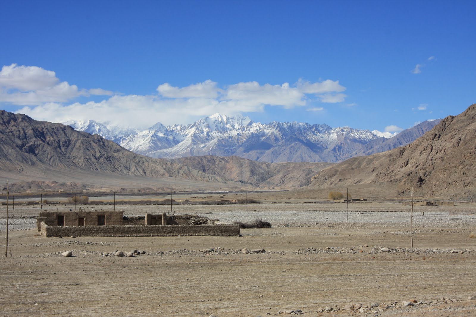
From Kashgar we spent a few days travelling south along the Karakorum Highway which cuts through the Pamirs and Karakorum mountain ranges to connect Kashgar and Islamabad. The road runs through high, desert like country, at times cutting through deep and narrow gorges, and at others crossing wide open boulder strewn plains and passing enormous frozen lakes. At all times the mountains dominated the views, their lower sections an amazing array of soft pastel colours with thick snow and ice above.


We spent two days in Tashkurgan, a small Tajik town close to the Tajikistan, Pakistan and Afghanistan borders, going for walks out across the plains, past shepherds and their huge flocks of sheep. Here we saw few cars, with most families owning a donkey and cart which forms their main form of transport. At a small village nestled at the foot of the hills a couple invited us into their home and served us bread and tea, humbling us with their generous hospitality. Lacking any shared language we communicated through mime and played with their two year old twins who soon got over their shock at having two odd looking strangers in their house. Their home was immaculately neat and tidy but almost entirely lacking in possessions: in the main room where we ate there were just a small stove, a foot-powered sewing machine and a collection of rugs and blankets. Amazingly, most of the people in the village seemed to speak not only no Chinese, but also no Uighur (the predominant language of the region), only Tajik, giving an indication of how localised their worlds must be. As in Mongolia, the sheer scale of the landscape with its wide open spaces and bright blue skies was incredible, and its colours and beauty wonderfully restorative.


Before leaving China we spent two days camel riding and camping out in the vast Taklamakan Desert, one of the largest sandy deserts in the world which covers an area of 270,000 square kilometres and was recently crossed on foot for the first time in 72 days. Although we ventured only a short way into the desert we soon felt disorientated and lost in the midst of high, shifting sand-dunes that stretched to the horizon with – to our eyes – no discernable landmarks. As elsewhere in Xinjiang we were struck by the vastness of the landscape and by the quiet that engulfs it: we saw no other people nor any sign of them while we were in the desert, there are no settlements there, and just a handful of wandering shepherds and occasional tourists, and a sense of great emptiness.


Just being in the desert was a wonderful experience, while the camel riding itself was also hugely enjoyable, with the motion of the animals similar to being on a gently rocking boat and familiar to us from our camel riding in Mongolia. Where that had been on flat stable ground however this time the animals had to clamber up and down unstable sand-dunes that looked just like the deserts of our imaginations.

Our ten days in Xinjiang have been a highlight of all of our time in China. Yet we would probably never have come to this beautiful and fascinating area if we hadn’t intended to travel on into Central Asia. It is an area about which remains relatively unknown in the West and of which we were largely ignorant before researching our route: though it occupies a sixth of China’s landmass it receives few foreign tourists, rarely features in the media and the chapter on Xinjiang was one of the shortest in our guidebook. Yet it is one of the most interesting, varied and beautiful places we’ve visited not just in China but anywhere and deserves to be considered as a destination in its own right.

Xian

Our first stop back in China was Xi’an, once one of the country’s four great ancient capitals. Xi'an became a cultural and political centre of China in the 11th Century BC with the founding of the Zhou Dynasty but it is perhaps best known as the capital of the first emperor of China, Qin Shi Huang, who unified China for the first time in the 3rd Century BC and after whom the country may have been named.

Like surely all other foreign visitors to Xi’an we made the pilgrimage to visit Emperor Qin Shi Huang’s vast army of Terracotta Warriors, which date from around 210 BC but were only discovered in their subterranean hiding place in 1974. The combination of the sheer number of warriors – the three pits so far excavated contain an estimated over 8,000 soldiers, 130 chariots with 520 horses and 150 cavalry horses – and the level of detail in their decoration is amazing. Not only are no two faces among the soldiers the same, but their clothes, hair and armour are all subtly different too, and all beautifully crafted. It is an awesome sight to look down on this vast army of life-size soldiers marching in neat lines in their sunken pits. Sadly however the curation of the museum is poor: visitors are kept well away from all bar five of the warriors, and many of the remainder are hard to see clearly in poorly lit pits. Even more disappointingly there were perhaps just 200 – 300 words of text in the entire complex about the Warriors and their history. Rather than informing visitors, effort seemed instead to have been devoted to profiting from them and we were confronted with countless opportunities to buy replica warriors of all sizes, to be photographed in front of other replicas, or even to have a personalised warrior made in our likeness – all for a fee of course.


As well as visiting the Warriors we visited the fascinating tomb of Emperor Jingdi, an Emperor in the Han Dynasty from 156 BC to 141 BC. Like Emperor Qin Shi Huang, Emperor Jingdi chose to be buried surrounded by terracotta figures, but Jingdi’s are much smaller than lifesize and there are few soldiers amongst the figures. Instead they provide an insight into everyday life, with groups of men, women, children, eunuchs and even hundreds of wonderfully lifelike sheep, goats, pigs, dogs and horses.

Xi’an – then known as Changan – also served as an imperial capital for later emperors from the 7th Century AD. A 9 mile city wall which was constructed in 1370 during the Ming Dynasty (1368 to 1644) survived the Cultural Revolution and remains intact to this day, and we spent an enjoyable few hours walking its length as the sun set over the city.


Other than the wall however not much remains of the city’s rich history. The historic Bell Tower at the heart of the city has been turned into a traffic island, accessible only via an underpass, and shares centre stage with an enormous shopping mall and an enormous and gleaming McDonalds. Arriving from Kathmandu this modernity was shocking but not altogether unwelcome: the clean, well-lit and wide, straight roads in such contrast to the over-crowded dark litter strewn alleys of Nepal’s capital, and the reliable hot running water and 24 hour electricity felt luxurious indeed.

As Xi’an was the Eastern terminus of the Silk Road it also seemed a fitting place for us to begin our journey home. Although the name, the Silk Road, wasn’t coined until 19th Century, goods have been traded overland between China and Europe since 1000BC, along the shifting network of overland trading routes that made up the various Silk Roads. We hope to travel some of those old trading routes, visiting parts of Western China, Central Asia, the Caucuses and Turkey, on our way.

Saturday, 2 April 2011

The Kathmandu Valley

Kathmandu, Nepal’s capital, is a city of contradictions: beautiful, alluring, even magical but also dirty, polluted and squalid. Its narrow streets, no more than lanes really, bend and twist and are lined with medieval buildings with window and door carvings of delicate beauty. Off them, accessible through unmarked doorways are small quiet squares and courtyards reminiscent of those in Arab towns. Yet the streets are permanently overcrowded: people are everywhere, honking traffic forms an endless procession, bicycle rickshaws and motorbikes weave in and out narrowly missing pedestrians, and the occasional cow is shooed out of the way. It is a kaleidoscope of colour, noise, bustle and all the more fabulous – and exhausting – for it.


We retreated to Kathmandu between our three treks, as well as at the start and end of our time in Nepal, to soak up some culture and enjoy the creature comforts unavailable in the mountains. We stayed in Thamel, the popular tourist district, which is packed full of restaurants, cheap hotels, and shops selling hippy clothes shops and outdoor gear. Lucky for us the supermarkets were stocked with tired, dirty and news-hungry trekkers in mind, with chocolate, Pringles, and even copies of the Economist available everywhere.

Historically, the Kathmandu Valley was split into three kingdoms, or city states: Kathmandu, Bhaktapur and Paptan, whilst the rest of modern day Nepal was a fragmented patchwork of almost 50 independent states. The country was unified, politically at least, in the late 1700s when Kathmandu became the capital and the Valley’s other Royal cities fell into decline. Luckily the medieval historic centres of all the three cities and their Royal (Durbar) Squares have been preserved.


We started our sightseeing in Kathmandu Durbar square, which houses 50 important religious monuments or shrines as well as the huge former royal palace. The monuments mainly date back to the seventeenth or eighteenth centuries, although some buildings are older, and are visually stunning, often shaped as stepped pyramids and adorned with intricate carvings of religious symbols and curiously erotic figures on beams and around doors and windows.


By day Durbar Square teems with life, with hundreds of traders and tourists dodging the traffic that incredibly hasn’t been banned from driving amongst the historic buildings, while other people relax on the broad stone stairways of the various monuments. The Square’s only permanent resident however is the Kumari. A small child deemed to be a living goddess, she shows herself to crowds of tourists, us included, at 4pm each day, until she reaches puberty when she is cast back to being a mere mortal.

In contrast to the hustle and bustle of Kathmandu, Patan and Bhaktapur’s Durbar Squares are an oasis of calm, where thankfully traffic is banned. Patan has arguably the finest collection of palaces and temples, whilst Bhaktapur’s is the most intact of the three cities and also benefited from a German funded renovation project in the 1970s. Bhaktapur is also further from Kathmandu and is pleasantly set amongst fields, with hundreds of largely traffic-free narrow cobblestone streets and squares which wind round crumbling old red-brick houses with intricate wood carved doors and windows. Wandering through the lanes we felt a strong sense of how medieval cities must have been. Life in Bhaktapur is much quieter than in the capital but the small streets still teem with life: children playing, old men sleeping in squares and women collecting water from wells.

Until 2008 when the Maoists achieved a majority in Parliament and abolished the monarchy, Nepal was the world’s only Hindu kingdom and religion, both Hinduism and Buddhism, remains an essential and highly visible part of Nepali life. Religious sites are everywhere in Kathmandu, ranging from the spectacular Swayambhunath, a 2000year old Buddhist stupa high which perches high on a hill overlooking the city, to small shrines and temples on almost every street, often neglected and almost ignored like the small 6th century statue of Shiva we saw in a niche of a wall in a unremarkable building housing a dental practice. Whilst the majority of Nepalis are Hindu (89.5% of the 24 million population), with only 5.35% Buddhist, many religious monuments are shared between the faiths and we were struck by the seeming religious and ethnic harmony that exists within the city with Hindus often worshipping at traditional Buddhist sites and vice versa. Religion also appears to be intrinsic to daily life and much celebrated, leaving the temples a wonderfully chaotic mess: in the mornings Nepali women flock to the temples and shrines to perform a puja, light butter lamps, scatter rice and daub yet more red tika paint on the statues, while around Buddhist homes and sites prayer flags flutter in the wind.

Pashupatinath and Bodnath are two of the most important Hindu and Buddhist sites in Nepal. Pashupatinath is the country’s most visited Hindu temple and when we were there was full of sadhus, Hindu ascetics who have renounced all their possessions for a nomadic life and eek out a living from begging or donations in return for posing for tourists’ photos. Pashupatinath is set on the banks of the Bagmati river, a tributary of the Ganges river, and thus considered sacred by Hindus, although we found it hard to see it as more than the open sewer it resembled, filled as it was with fetid garbage. For Hindus however it is the cities most sacred cremation site: those approaching death are lain on the banks with their feet in the water until life drains out of them whilst dead bodies are cremated on open slabs of stone and then rather unceremoniously, to our eyes, dumped in the river.


Bodnath is an immense 40m high white Buddhist stupa, the most important Buddhist site in the city and the heart of the Tibetan exile community. The stupa itself is surrounded by a circle of monasteries, houses and shops selling Buddhist paraphernalia, reminding us of Lhasa in Tibet, and as in Lhasa we spent several peaceful hours just watching people making slow circuits of the stupa, spinning prayer wheels as they walked.

For our last week in Nepal we headed back to the mountains for a few last days walking, this time in the lower slopes of the Himalayas (just 2000m-3500m) to the north of Kathmandu. To get to the trailhead took a short but heartbreaking taxi ride from central Kathmandu, out through the city’s rapidly expanding northern suburbs. Here the worst effects of rapid, unplanned, unchecked urban development were all too obvious: the landscape littered with poorly built, often unfinished dwellings of bare breezeblocks, all built without the necessary infrastructure and surrounded by the detritus of construction. And so abandoned piles of cement, gravel, sand competed with the usual urban litter of plastic bags, tin cans broken glass food wrappers all stretching out as far as we could see through the smoggy haze that envelopes the Valley. And in amongst the new buildings and their squalor were still just hanging on the remnants of an old and dying way of life: villages of one or two storey brick buildings surrounded by small fields of barley or potatoes, all disappearing under a tide of concrete and plastic bags.


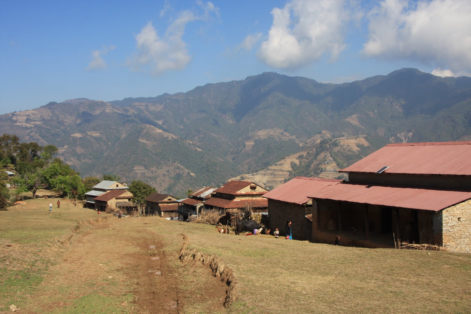
Luckily – for us if not for the residents of the Kathmandu suburbs – the trail quickly climbed away from and out of sight of the Valley and for the next six days we walked through small villages and beautiful terraced fields and of mustard and potatoes, separated by forests of pine, holly and rhododendron covered in bright red, white and pink flowers. While not as dramatic or spectacular as the mountain scenery we’ve seen elsewhere in Nepal the landscape in this region was still very beautiful. Even for the first half of the trek when we were surrounded by thick mist the mixture of woods and farmland appeared beautiful and for the last day we had wonderful views out across the terraced slopes and populated valleys.


Being at lower altitudes we also saw more birds and wild animals than elsewhere, and unlike in the Everest region we had the trails to ourselves for most of the day, providing a tranquillity we’ll no doubt crave in a few days when we’re back in urban China. In several places at lower altitudes, our narrow and steep path cut across new roads that are being driven through this landscape. While these roads remain un-surfaced for now, and in six days we saw just one aged bus using them, it is clear that they will transform life in these villages previously only accessible by foot, and outside many of the wooden houses already stood gleaming new motorbikes – still unseen in the other areas we’ve walked through.


We’ve had a wonderful time in Nepal both in the cities and in the mountains. It is a beautiful country with a fascinating culture yet it remains desperately poor. Infrastructure badly needs improving: the roads, waste management and the energy system particularly. The traffic in Kathmandu is almost at breaking point, while the pollution means the city is constantly covered in a smoggy haze. To save the electricity grid from meltdown power is turned off for more than 16 hours a day in the city and the valley. It seems unbelievable that a capital city must survive on only 8 hours of electricity a day, with five of those typically in the middle of the night. Amazingly villagers in the remote countryside with small scale community hydroelectricity plants often fare between than their city counterparts with more reliable electricity. Large parts of Kathmandu and the surrounding valley are also squalid. Yet despite these problems the Valley’s cities remain beautiful and vibrant and we hope desperately that something can be done to preserve their charm and alleviate the problems that afflict them.

Thursday, 24 March 2011

Trekking in the Everest Region

“I felt I could go on like this forever, that life had little better to offer than to march day after day in an unknown country to an ... unattainable goal.” (HW Tillman, one of the first Westerners to visit the Khumbu Valley below Mount Everest describing his journey in 1950)

While the area may no longer be unknown, the sentiment Tillman expressed of walking day after day in the mountains close to Mount Everest appealed to us enormously. There is no doubt that it was Everest itself which was, initially at least, the draw of visiting the Khumbu region and we hoped to reach its Nepalese Base Camp, having visited the Northern Base Camp in Tibet in December. Yet whilst it is impossible not to be impressed with the size and bulk of Everest and feel admiration and respect for those spending two months attempting to climb it, to our surprise it was other views and experiences that we enjoyed more and which will form our lasting memories of our time here. For Everest itself, unlike the mountains that surround it, is of no great beauty when viewed from the south, and is also surprisingly shy, only occasionally revealing any of itself and then just the tip of its peak (in the photo above, Everest is the nondescript looking grey triangle in the middle of the skyline with clouds billowing from it). And so instead we found ourselves drawn to the lesser known but to our eyes more beautiful peaks of the region: the wonderful of Cho Oyu and Lhotse (both, like Everest, over 8000m), the iconic Ama Dablam (photo below), the beautiful Nuptse, Thamserku, Kangtega and Kusum Kangaru and the numerous other mountains that jostle for position. Seeing and recognising these great mountains from different angles and in different conditions became a highlight of our walk, as were the “lesser” views of lush foothills and picturesque villages, and our interactions with local people that.


The Khumbu region, in which Mt Everest is situated, is located in north-eastern Nepal, with Mount Everest in the far north, forming a pyramid with three great ridges, along two of which run the border with Tibet. Four main valleys run down from Everest and the mountain ridge, all of which ultimately feed into the Dudh Kosi river valley, at which Lukla, the gateway to the region, sits at the bottom. We set aside 21 days for our walk to give use time for a circular route crossing and exploring the four valleys and some of the lesser walked side valleys, rather than just walking straight to Everest Base Camp and back. Achieving this would involve crossing two challenging mountain passes both at over 5300m, as well as attempting a couple of peaks, also at 5300-5550m.

To give us more time in the mountains, we skipped the six day walk and 10 hour bus journey from Kathmandu, and instead flew (again breaking our no fly rule...) in to Lukla on a small twin propeller plane. It was an exhilarating start: flying through the wind and clouds in an extremely mountainous region before landing on a very short and steeply sloping runway with a sheer drop at one end and a cliff at the other! Kieran was terrified, Rachael very nauseous.


Within a day and a half of walking we had our first views of Everest from Nepal as we approached the bustling regional capital of Namche Bazaar. We spent a couple of days there acclimatising, enjoying the stunning views of the nearby peaks of Kongde, Thamserku and Kusum Kangaru – none household names but all beautiful mountains which we were to see again and again during our trek – and exploring some of the surrounding villages. The villages at the lower levels of the region (between 3000m and 4000m) are colourful, prosperous and vibrant and tend to be set in natural amphitheatres, with houses and fields intermingled up the slopes. Almost all are beautifully situated, overlooking valleys and snowy peaks, with well built stone houses, and with dry stone walls dividing fields and marking out paths so that at times they resemble villages in the Lake District.


The Khumbu region is home to the Sherpa people, ethnic Tibetans who migrated to Nepal over the high Himalayan passes in the 16th Century, and there remain distinct similarities with Tibetan culture: Tibetan Buddhism is practised widely, the architecture and traditional dress are similar to that we saw in Tibet, while traders still carry goods by yak over passes between the two countries. Also unsurprisingly, given its close proximity, the landscape, was in places very reminiscent of Tibet: early on in our walk we followed an arid, sandy and treeless valley just like those we passed through in Tibet to the north of Everest and which we later found led to a mountain pass still used by Tibetan and Nepalese traders and which leads to Rongbuk Monastery in Tibet, were we spent the night in December.

We were, for most days, blessed with beautiful, often cloud free, deep blue skies, with only a slight breeze in the air. The snow capped mountains framed against the blue sky and with the green valleys below looked almost indescribably beautiful and spectacular. A couple of heavy snowstorms reminded us how quickly conditions can change in the mountains, with thick mist and heavy snow replacing clear blue skies in just a few minutes, and the ensuing layer of snow utterly transforming the landscape.


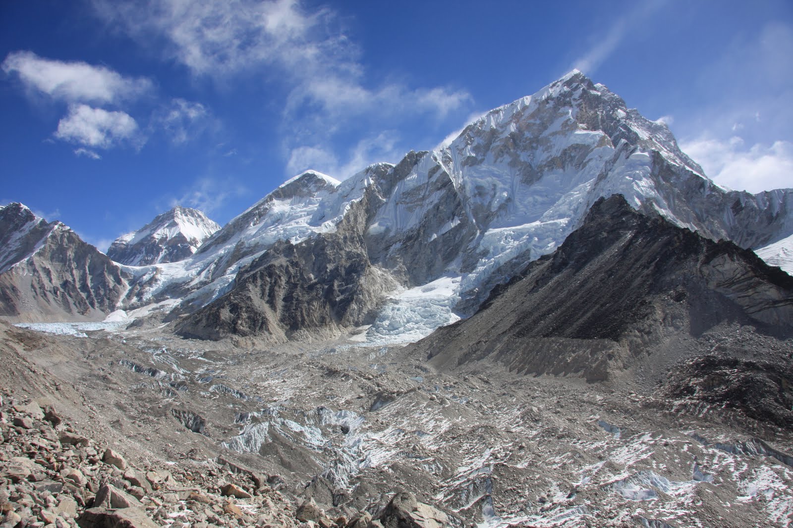
As we climbed higher into the mountains the landscape changed and the temperatures dropped enormously. The green valleys and fields with grazing livestock gave way to high sparse forests of pine and rhododendron which in turn gave way to open hillsides of short cropped grass and bushes of juniper and berberis, and then to sandier and more barren scrub land until we reached the desolate glacier moraine. Here the landscape consisted solely of bare rock and ice, with huge boulders and unstable scree slopes, with many of the paths snow or ice covered. After snowfall, the white glistening snow softened this harsh landscape, but at other times it felt like you could be on the moon.


At these higher altitudes, water froze in our bottles within a few minutes, and even our suncream, toothpaste and baby wipes froze in our rucksacks. Reading of GH Bullock, a member of the first Everest reconnaissance expedition of 1921 who, writing at over 20,000ft, commented “having only brought one coat which was wet, spent the evening in a sweater. Luckily I had two” we were grateful for the yak dung fires lit in the lodges in the afternoons, and for our warm down jackets and sleeping bags and multiple blankets which all helped stave off the cold. At higher altitudes too, the lodges where we stayed became noticeably more basic: in the lower regions many were family run, often set up on the back of the husband or son’s proceeds from acting as a climbing guide on Everest, and were hospitable, warm and well cared for. As we climbed higher the standard dropped with the temperature and most seemed to be staffed by surly teenage boys or young men with, apart for the odd exception, few cooking skills and no time for sanitation, while the toilets were uniformly frozen. Luckily the views and the knowledge we nearing Everest and the other high mountains compensated for these hardships.


It was sobering to realise that, with the exception of potatoes (which have been grown in the area since the 1800s) and cheese, everything we ate during the course of our three weeks in the mountains, as well as the beds we slept in, tables we ate at, stoves we sat round and everything else we used had to be carried in, usually on the back on a human porter who seemed to invariably carry very heavy loads for very low wages. One lodge owner we talked to paid porters just under £1 for every kilogram they carry in from the nearest road, a 10 day walk away. With porters typically carrying 60kg to 120kg – all from a strap across their foreheads – this means earning £50 to £100 for 10 hard days hard slog into the mountains, and another four days out again. As we struggled up some of the steeper slopes it was humbling to be passed by men carrying huge quantities of tins, plywood or even, on one occasion, a metal filing cabinet. And unlike the guides who bring tourists to particular lodges and receive free board and lodging in return, porters have to pay for their food and accommodation.


Walking in this region required us to change our walking mindsets. It no longer made sense to measure how many miles we walked, and instead we had to think in terms of altitude gained and hours taken. For example from Namche Bazaar to Everest Base Camp is only 22 miles but even the most direct route requires 7 days of walking, while we spent 3 tough days covering just 12 miles because of the enormous height gained and lost on the trail. At other times the rapid height gain made for frustratingly short days where, after walking just 2-3 hours, we had increased our altitude as much as was safe or sensible for one day. Above 4,500m the altitude proved difficult. It was noticeably harder to breathe and even slight inclines became more taxing than they would have been lower down, so that it felt we were dragging our legs up the hills rather than being propelled up by them.

Even struggling with the altitude though we made it over the two 5300+metre passes, both requiring steep and long climbs up rocky slopes but rewarded by stunning views of mountains, snow covered lakes, frozen waterfalls and glaciers (the photo below is of us at 5368m at the top of the Cho La Pass). From the summits we scaled we caught glimpses of Everest, tucked almost out of sight behind its guardian peaks, as well as 360 degree views of some of the highest and most amazing mountain scenery we’ve seen anywhere. The rivers we crossed at higher altitudes were a mass of ice and snow, their surfaces frozen solid in and with boulders covered in a thick crust of ice while the water continued to flow underneath; frozen lakes with ice a foot thick or more creaked and groaned in the sunshine as sections thawed slightly, and glaciers echoed to the sounds of cracking ice and falling rocks.


One of our most enjoyable days we walked in flawless weather to the base camp of Ama Dablam, considered by many to be one of the world’s most beautiful mountains, with spectacular views of both Ama Dablam and its surrounding peaks, and the areas through which we’d walked over the previous few days.

By contrast, Everest Base Camp, which is perched on the glacier near the spectacular Khumbu Ice Fall, offered no views of Everest and only served to remind us how cold and uncomfortable a base it must be for the mountaineers who set out to climb it. When we visited, Base Camp was deserted and only marked by a graffiti-covered boulder and strings of prayer flags.


On our walk back to Namche though we passed caravan after caravan of yaks laden with equipment and food, on their way to set up camp for the first expeditions of the year. Interestingly, yaks are frequently used to carry loads in the Khumbu region above Namche but can’t be used to carry supplies in from the roads or airstrip as they’re unable to go below 3000m without falling ill or dying from a kind of reverse altitude sickness.

The Buddhist religion is very evident in the region and seems to blend seamlessly with the landscape. There are monasteries in all the year round villages, although not all with active communities of monks and nuns, usually tucked into the hillside above the houses and painted in vibrant red and gold. Colourful prayer flags and chortens mark the top of a ridge or a mountain pass, and mani stones (stones inscribed with prayers) and chortens line the paths around the villages. While it would easy to over-romanticise the link the Sherpas have with the land – they have made tragic mistakes too such as deforestation – the landscape does appear to be an important force in their spiritual well being.


One of the unexpected highlights of the trip was having being exposed to a very different culture. We had decided to trek without a guide to give us more flexibility about our route and to save on costs but hadn’t anticipated that this would also bring us much more direct contact with lodge owners, as we had to organise things ourselves. As a result we spent many enjoyable and fascinating hours talking to the people who ran the lodges. Indeed, most of the Sherpa people we met were friendly and kind to us, and it was fascinating to gain ain insight into their lives. We left the region with admiration not just for their ability to live in such a harsh and inhospitable environment, but for their approach to life. While it would be easy to romanticise their rural existence, people seemed genuinely content with lives that seemed very peaceful and which were largely unemcumbered by possessions (although in some part this material poverty) and the external stimuli of television, radio and neon that we surround ourselves with, and seemed largely free from the drive of competition, even when competing for tourist business.


We frequently wondered about the impact we and the 20,000 or so trekkers that visit the Khumbu each year have on local culture. For such an influx must undoubtedly have affected local customs, though we hope and feel that the exchange is not entirely negative: walking boots and outdoor clothes, often mixed with traditional clothing, are now staple items of Sherpa clothing because they are warmer, more durable and cheaper than previous alternatives, while increasing numbers of buildings now have electricity and fitted windows. It would also be arrogant to assume that a few decades of Western influences would be enough to destroy centuries of indigenous culture, and naive to overlook the significance of the topography on local culture: vehicles are useless on this terrain so fields will continue to be ploughed by beast or by hand, and goods moved on foot, while schools and hospitals will continue to be a few hours walk away for most people. So while life is undoubtedly changing in the Khumbu for the local population, it still remains culturally distinct even from the life of other Nepalis.

At the start of our trek, 21 days had seemed an enormous amount of time to spend walking: longer than either of us had ever walked for before and longer even than we’ve spent in whole countries on this journey. And yet the days flew by as we quickly settled into the simple and easy routine of walking, eating, sleeping, with plenty of time to read, reflect and enjoy the views. By the end there were certainly things we were looking forward to about returning to Kathmandu: showering and feeling clean for the first time in 3 weeks, being able to contact friends and family again, escaping the cold and choosing from a more diverse menu all spring to mind. And yet we were also sad to leave the mountains behind. And while we will undoubtedly enjoy more mountain walks in the future, it is hard to imagine any other area providing as consistently beautiful views as this stretch of the Himalaya.

Wednesday, 23 February 2011

Annapurna Sanctuary Trek, Nepalese Himalaya

The Annapurna Base Camp sits at the heart of the Annapurna Himalayan Range, at the foot of Annapurna I, the tenth highest mountain in the world and the first peak over 8000 metres to be climbed. And it was the Base Camp, at an altitude of over 4100 metres, which was our goal on our first trek in Nepal.

For the first two days of the walk we climbed in glorious sunshine through terraced fields of potatoes, mustard, corn and vegetables, past small villages of stone-built houses with blue tin roofs and then, higher, through forests of bamboo and of flowering rhododendrons.


At night we slept in small stone lodges which are found every couple of hours or so along the trails. The lodges are basic affairs, with (usually unheated) communal dining rooms, spartan twin bedrooms and outside squat toilets. In the evenings we huddled in the dining room, with blankets draped over us for warmth, and for supper ate Dal Bhat, the Nepalese national dish which consists of unlimited quantities of rice, lentils, curried vegetables and pickle. Amazingly though, while national power shortages mean electricity is switched off for 14 hours a day in Kathmandu and the other major cities, in the mountains micro-hydroelectric power stations and solar power meant almost every lodge we stayed at had 24 hour electricity.


Since the Maoists ended their insurrection and joined the Government, prices between the lodges have been standardised, ensuring consistent prices within an area, although costs still understandably rise significantly the further you get from a road, with all ingredients (as well as the beds, tables and everything else in the lodges) brought in by porters who carry seemingly impossible loads from straps across their foreheads.

Then, for two days – very unusually for this time of year – the weather was overcast and foggy with frequent and heavy storms that delivered rain at lower altitudes and snow higher up. Even in the mist however, and deprived of spectacular views of the mountains, the landscape remained beautiful, with glimpses of snow covered peaks through the cloud, and trees silhouetted against the fog.

On the second stormy day we heard from several lodge owners and trekkers that the bad weather was set to last at least a week, and, more worryingly, that the route to the Base Camp was impassable because of deep snow and a high avalanche risk, but we decided to press on anyway and see where we got to. And the following day we were rewarded with cloudless skies and our first clear views of the mountains, with the un-climbed and iconic Machhapuchare (nicknamed Fishtail because of its distinctive shaped summit) standing clear of the other peaks ahead of us.

As we progressed up the deep valley towards the Base Camp the views became increasingly dramatic, with cliffs covered in snow and ice soaring above us, while the snow got deeper and the temperature plummeted to well below freezing in the shade and even colder at night. On the sixth day of the trek we set off early from our lodge near the head of the valley hoping to make it to the Base Camp that day, although we’d passed no one in the previous two days coming the other way though who had succeeded. By now the entire landscape was white, with the snow on the trail up to our calves and drifting much deeper, and the temperature so low that there was no running water and we had to break the ice on buckets of water to fill our water bottles or flush the toilet.


Unlike seven years ago when Kieran trekked in Nepal before, most of the other trekkers we passed this time were Asian, with more South Koreans trekking in Nepal than any other nationality. The Koreans we saw tended to walk in large groups with a huge number of support staff. For three days we kept pace with a group of 19 Koreans, who were accompanied by 29 porters and chefs (they brought all their food with them) and 5 guides. This increasing number of Asian trekkers has led many of the guides we met to study Mandarin or Korean, rather than English (though they all spoke at least some English too). That day we were particularly grateful to the Koreans’ porters who helped forge a path through the snow as far as Machhapuchare Base Camp, just a couple of hours walk from Annapurna Base Camp, without whom we wouldn’t have made it.


Here though the Koreans stopped and so for the last two hours and 450 metres of ascent we followed a single set of footprints through soft powdery snow that was never less than knee-deep and in places had drifted to a depth of a metre or more. We made slow progress but didn’t mind for the views were just magical: snow-capped peaks on all sides soared above us and sparkled in the bright sunlight; bright blue glaciers ran down to the snow fields and above us huge cloudless deep blue skies.


We arrived at the Base Camp shortly after one o’clock, only the second and third people to make it in 4 days, and sat outside marvelling at the beauty of the setting until the clouds blew up and the cold drove us inside. The lodge we stayed at was almost hidden by snow that had drifted within a foot of the roof, and the snow that had blown inside our room didn’t melt in the 24 hours we were there, while the kitchen and toilet floors were both covered in a thick layer of ice. Yet even in these conditions the friendly host managed to cook some of the best food we’d eaten on the trail.


The next morning we were up early to see the early morning sun light up Annapurna I and the even more beautiful neighbouring Annapurna South. Then, once the sun had appeared over the peak of Machhupucare and the temperature had started to rise we set off for four day walk back to Pokhara, the nearest town to the mountains: first slipping and sliding through the snow and ice as we dropped over a vertical mile; then climbing and descending seemingly endless stone staircases; as well as making time to spend a leisurely and very enjoyable afternoon at some natural hot springs - the first time we’d washed or felt warm enough to take off clothes in over a week.


Back in Pokhara we were finally able to celebrate Kieran’s birthday (which had passed while we were in the mountains) with a slap up meal and our first alcoholic drinks in 10 days. And then, as the sort of once in a lifetime experience that seemed a fitting way of celebrating the big 3-0, Kieran went parahawking (paragliding with a bird of prey) over Pokhara. Parahawking only exists in Nepal and was set up by a conservation organisation working to raise awareness of the dwindling numbers of Himalayan Vultures (over 99% of the birds have died in the past 15 years) and to fund further conservation efforts. And the flight itself was just magical – from stepping off the mountainside at about 1400m the pilot (who was strapped to me!) and I climbed a further 400m in the thermals, with amazing views of the terraced hills stretched out below us and the snowy mountains glistening in the distance. The flight was amazingly calm and almost silent – hard to believe we were travelling at 20 to 35mph – and felt comfortable and secure throughout, and really just like we were flying. And throughout the flight we were joined by Bob, an Egyptian Vulture who’d swoop in and land on my hand mid-flight to take food before soaring off again on the thermals...