Sunday, 29 May 2011

Turkmenistan

Before we visited we knew very little about Turkmenistan, a small, mysterious, desert republic squeezed between Uzbekistan, Afghanistan, Iran and the Caspian Sea, except that it was a totalitarian state with leaders who sounded decidedly weird: the previous President had changed his name to Turkmenbashi (Leader of the Turkmen), renamed the days of week and months of year after himself and family members and – declaring his “reign” a new Golden Age of Turkmenistan – erected enormous golden statues of himself around the town. We’d heard that since his death in 2006 his successor had toned things down a little, and implemented some much needed reforms but with the media so controlled we had no real idea what to expect.

Unfortunately, the restrictions placed on foreign travellers meant that we were limited to just a few days in the country. Yet even in our fleeting visit we saw that the cult of personality of the President continues to be cultivated: photos of the new President are everywhere and he has even built a National Museum focused on himself. We were fascinated by the contrast and contradictions between the ostentation of the grand buildings of Ashgabat and the apparent paranoia of the regime, and the gulf between the wealth and grandeur of the city and the poverty of the provincial towns and villages we saw.


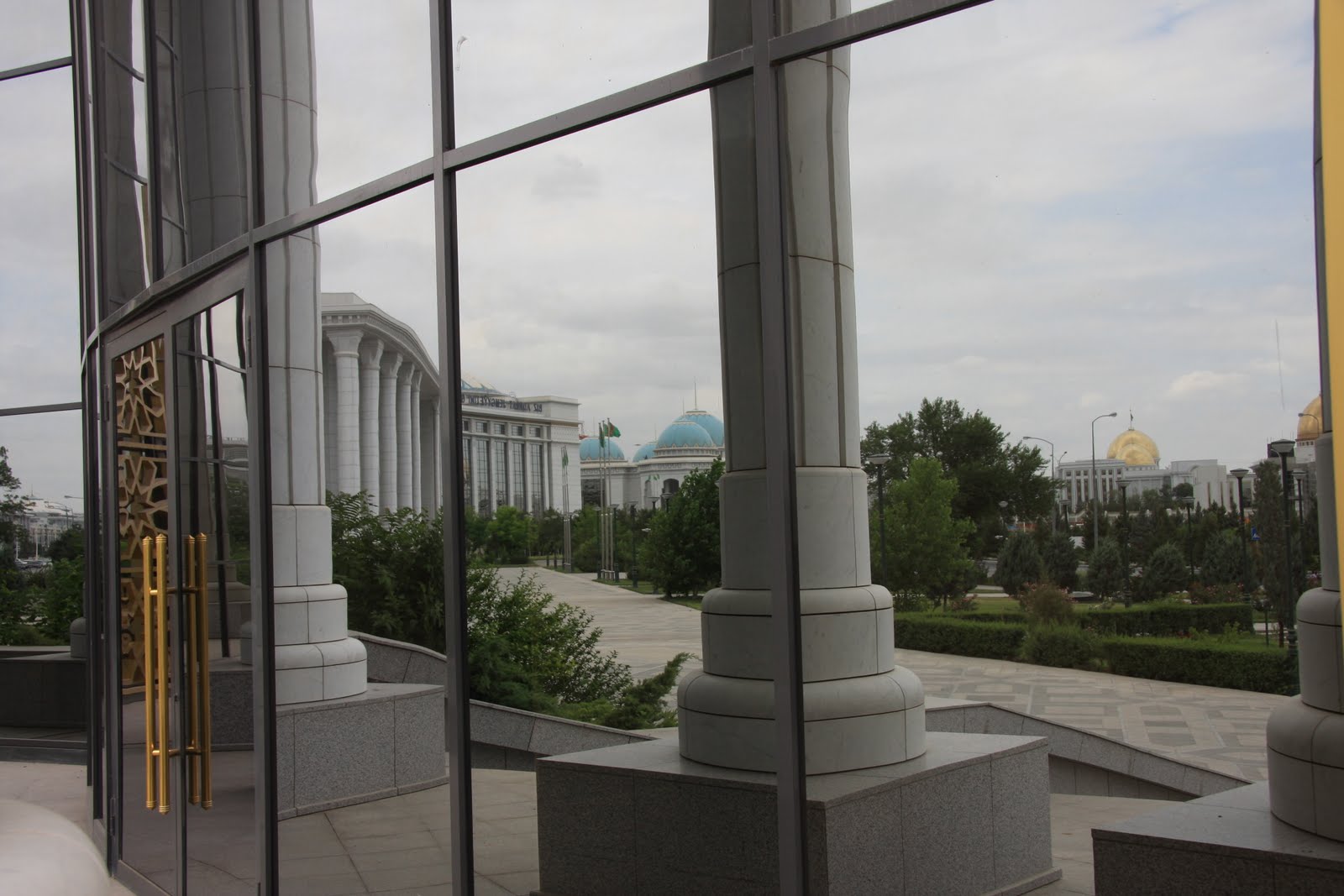
Ashgabat seems designed as a showcase city to show-off the brilliance and wealth of Turkmenistan. It’s a mix of lavish white marble palaces, gold statues and domes, huge manicured parks and extravagant water features. The city is so green with trees and glorious flowerbeds it seemed unbelievable we were in the midst of a desert. The huge Government Ministries, all white marble of course, line the central streets, with fabulous Orwellian names like the Ministry of Fairness. Yet the buildings all seemed curiously quiet and we couldn’t quite believe there were enough staff to fill them. On the edge of the city are row after row of neoclassical mansion blocks of flat, all 12-15 stories high and clad in the obligatory white marble. At night the city is illuminated in garish colours, which seemed reminiscent of Las Vegas and a long way from the old Silk Road cities of Uzbekistan.


The President’s “main goal is...reviving the cultural and spiritual heritage of our nation”. This is clearly visible throughout the country: women are encouraged to wear only the national dress, while the output of the five domestic tv channels is limited to folk singing and dancing, and the statues around Ashgabat depict traditional nomadic Turkmen and their glorious and ancient past. These conveniently ignore both the Soviet period and that nomadic Turkmen were notorious for abducting and enslaving Russians and Persians. Our first day in Ashgabat we chanced upon a parade celebrating the end of the school year and it was fascinating to see a large choreographed set piece. Thousands of students in matching national dress were assembled to march in the parade, line the streets waving huge flags, or take part in traditional dances. Bizarrely though, we seemed to be the only spectators as it was largely being filmed for national television.


Walking about in Ashgabat there is no doubting that you are in a police state. There are policemen or soldiers on every corner and guarding every building and park. On many streets they outnumber the pedestrians. Armed with frequently used whistles, they continually direct people to one side of the street or the other, often for no apparent reason, and become agitated if you venture within about 30m of any building or loiter near one. Photographing any public building is strictly forbidden and so we had to become quite clandestine about taking photos and confine ourselves to capturing the residential buildings and parks outside the centre, which are less grand and less well guarded. These restrictions were mirrored in the rules for foreign tourists, who are obliged to travel with a Government authorised guide and are only permitted to stay in the few hotels set aside for foreigners (all apparently bugged).


Turkmenistan’s wealth comes from its huge reserves of gas and oil (it has the world's fourth-largest reserves of gas and substantial oil resources) and on our drive to the Caspian we saw the oil rigs stretching out across the desert. A great deal of this wealth has been spent on Presidential ‘vanity projects’, such as the new 66,000 capacity Olympic Stadium, which is curious as sports have declined in Turkmenistan since independence and apparently no Turkmen has ever qualified for an Olympic event. Similarly, a huge amount of money is being spent on developing the Caspian Sea coast as a tourist destination but unless travel restrictions and exorbitant visa fees are waived we can’t see which tourists they will attract for a break in the sun.

Much of this spending has probably resulted in less investment in other much needed infrastructure in the country, but a lot of oil and gas revenue does subsidise life in Turkmenistan. Gas, electricity and water are all free. Food – even imported foods - are heavily subsidized in the shops (for example a 500ml bottle of coke or a Mars Bar are both about 20 pence), as is transport with car drivers entitled to 120 litres of free petrol a month (and petrol costing 12 pence a litre after that) and a bus ticket in the city costing only 4 pence. The Government provides credit for people to buy property and only charges 1% interest on loans. Taxes too are kept very low: the maximum rate is only 2% and those who work in agriculture pay no tax whatsoever.


Our guide, an ethic Russian with Turkmen citizenship, was – at least to us – an emphatic supporter of the regime and extolled the virtues of the high quality of life of people experience in Turkmenistan. It certainly feels much more affluent than either Uzbekistan or Kyrgyzstan, not least on the roads where battered Ladas have given way to gleaming new Toyotas and Mercedes Benz. However these perks were less relevant in a village we visited in the centre of the country where there were no mains energy supplies, little public transport and housing looked extremely dilapidated. A group of American Peace Corps volunteers working in Turkmenistan we met disputed our guide’s account, and believed that most of the population remained very poor.


From visiting the President’s National Museum, we learnt that the current President was elected in 2006 following the death of the first President with a staggering 89.2% of the vote – even his main opponents supported him. The museum is hilariously packed with badly staged and photoshopped images of the President engaged in cultural pursuits: sitting outside a yurt, cooking plov, the national dish, on a mud stove, or riding a horse, as well as more modern pastimes like driving a speedboat, riding a bicycle, playing a guitar and at a shooting range. His target is even on display with the label noting his “unbelievable” perfect score! There are also photos of the President with all the world leaders he has ever met and the gifts he’s received from them.

Despite the President’s pre-election promises of reform, he remains all powerful and there is no separation of powers in Turkmenistan (the Executive, Parliament and Judiciary all report to him) and thus there are no checks and balances on his power. The museum even states that the role of Parliament is to “accept laws” the President has decreed. The President has said that “the greatest value of our society is an individual, its rights and freedoms. Today it is at the centre of our state policies”. Yet the Peace Corps volunteers we talked to suggested that life was still extremely oppressive for the people they lived and worked with, as well as for them as foreigners. Even after only a few days we found the continual police presence oppressive and were disturbed to learn that Reporters Without Borders ranked the country second to last in the press freedom index, only ahead of North Korea.

We’d entered Turkmenistan from the north, in a region that offers another example of Stalin’s damaging carve up of Central Asia. The ancient kingdom of Khorezm which existed in this region was divided up between Uzbekistan and Turkmenistan, meaning that there is a large Uzbek population in this part of Turkmenistan and that there are similarities between the local ancient architecture and that we saw in Uzbekistan. For example, a 12th century Mausoleum, the II-Arslan Mausoleum, features a conical dome tiled with turquoise tiles in a zigzag design, which is the first of its kind and was exported to Samarkand by Timur. It was also interesting to see the different approaches Uzbekistan and Turkmenistan have taken to conservation and restoration. In Uzbekistan most ancient buildings have been restored (and even rebuilt) to reflect what they may have looked like when new. In Turkmenistan the focus has been on only rebuilding sections that threaten the collapse of the building. No new decorative work has taken place. This may make the monuments less awe inspiring on first sight but chancing upon an original and perfect piece can be even more rewarding, for example the original 12th century sparkling mosaic ceiling we saw in the Turabeg Khanym Complex.


From Konye-Urgench we travelled south to Ashgabat spending a night en route camping at the Darvaza Gas Craters. Sadly the village of Darvaza no longer exists (the old President didn’t like the sight of it when visiting the new nearby highway and ordered its destruction) but the gas craters, 10km off the highway in the desert, are one of the most surreal sights we’ve seen so far. The craters were dug during soviet gas exploration in the 1950s and one was set alight and is still blazing after 60 years. At night the inferno is particularly dramatic, drawing many comparisons to the gates of hell.


Similarly bizarre was the Kow-Ata underground lake, another contender for the most unusual sight we’ve seen, and certainly the strangest place we’ve ever swum. As we climbed down into the cave, the air got hotter and the smell of sulphur grew stronger until we reached the lake, 65m underground, which is naturally heated to about 36 degrees where we spent a very enjoyable morning swimming and lazing about while bats flew about overhead in the gloom.

Saturday, 21 May 2011

The Silk Road Cities: Samarkand, Bukhara and Khiva

Uzbekistan’s prime tourist attractions are the ancient Silk Road cities of Samarkand, Bukhara and Khiva. All three grew rich on the back of the trade that passed through Central Asia: gold, saffron, cucumbers, pomegranates, peaches and wine passing from west to east, while ceramics, cinnamon, rhubarb and bronze, as well as silk and the secrets of paper making, printing and gunpowder travelled from China to the West. Indeed, it was the cultural as well as mercantile exchange which made the Silk Road so remarkable – with Buddhism, for example, taking route in Central Asia, China and Tibet as it withered in India, while the ancient art of Central Asia is a fascinating mix of Indian, Persian, Chinese, Arabic and even Greek influences.

In reality, there was never a single, static Silk Road but rather a network of routes that evolved and shifted depending on the season, political considerations, and regional differences in rates of tax, piracy or both. Yet sited around oases at crucial crossroads of the various routes, Samarkand, Bukhara and Khiva all became mainstays on the various trading routes that passed through the inhospitable deserts of Central Asia.

Samarkand

Samarkand, the most spectacular of the Silk Road cities, is as old as Rome with urban settlements dating back to at least the 6th Century BC, and a history of human habitation going back up to 40,000 years. Until the 16th Century it remained Central Asia’s leading city in terms of population, commerce and culture, with its heyday during the 14th and 15th Centuries during the rule of Timur and his immediate successors. Proclaiming himself Conqueror of the World (though known more commonly known in the West as Tamerlane), Timur led his soldiers as far afield as Delhi and Moscow, plundering Syria, Persia, Asia Minor and Russia in the process, the greatest extent of territory ever conquered by a single leader.

From the areas he conquered Timur carried back to Samarkand not just wealth but also the finest thinkers and craftsmen to create his imperial capital. While just a handful of these buildings remain, they dominate the city with their scale and beauty, their huge vivid turquoise domes standing out against the usually bright blue skies.

At the heart of the city is the Registan, three enormous medrassahs (religious schools) set around a large open courtyard, described by George Curzon, Viceroy of India as the “noblest public square in the world.” It is the combination of the vast scale of these buildings – the portals of the two facing medrassahs are each over 35 metres high – and the delicacy of the tiling and mosaic work that is so breathtaking. The bulk of the structures are the colour of the desert sand, with the walls and minarets decorated with tessellating patterns and inscriptions from the Koran picked out in deep blue, turquoise and green, while the portals are a seething mass of geometric designs, and swirling, floral patterns. And while you might expect so many competing and conflicting patterns to clash, the simplicity of the structure and the limited palette brings instead a beautiful coherence to the buildings, with the endless patterns continually absorbing. We stayed just around the corner from the Registan, and found it wonderful to be greeted by the domes of the Registan every time we emerged from our guesthouse and to see these majestic old buildings at various times of the day and in different lights.


Interestingly, on the facade of one of the portals, two tigers are clearly depicted and above them human faces looking out over the square from behind two rising suns. Although this was the most dramatic example, we were to see similar breaches of the Islamic rule against figurative art on several other religious buildings in Uzbekistan – a sign of the multiple influences on architecture in the region, and the way that only elements of Islam were ever adopted.


Elsewhere in Samarkand, Timur’s own mausoleum and the Bibi-Khanym Mosque he built to be the largest in the world are both stunningly beautiful, and like the Registan are decorated with intricate mosaics and tiling and topped by soaring turquoise domes. The mosque, which is still the largest in Central Asia, with a court once fringed by over 400 cupolas and marble columns has been beautifully restored externally but left untouched inside, giving an insight into how all these buildings would have looked before restoration, with broken lattice windows, cracks developing in the brickwork and only some tiling remaining.

A short walk from the other monuments, the Shah-i-Zinda is a collection of mausoleums dating from the 14th and 15th Centuries. With each monument smaller and more intimate than the grand central buildings it was possible to see the detail of the tiling and frescos much more clearly. . Although at times the mixture of styles was overwhelming, the views along the “avenue” of mausoleums were stunning.

In the last few years the city has undergone large scale restoration and even reconstruction. As always we were torn over the merits of such dramatic rebuilding, though it was fabulous to see the grand buildings looking like they might in their heyday. Unlike many of the historic sites we’ve visited on this trip it was also wonderful that the streets around them have been pedestrianised so we could enjoy them without dodging traffic, making the city an incredibly relaxing and easy place to spend time. Yet the decision to build high walls around the monuments and the older, residential areas of town, segregating local people from their history and from tourists, felt sad and utterly unnecessary.

On several occasions we succeeded in finding the small gates that gave access to the warren of residential streets hidden behind the new walls, gaining a glimpse of a fascinating and very different side of Samarkand: quiet narrow alleys lined with houses set round courtyards, where water is piped in through metal pipes laid above ground, passing groups of men visiting the neighbourhood hammam and huddles of women squatting outside their houses talking with neighbours.


Bukhara

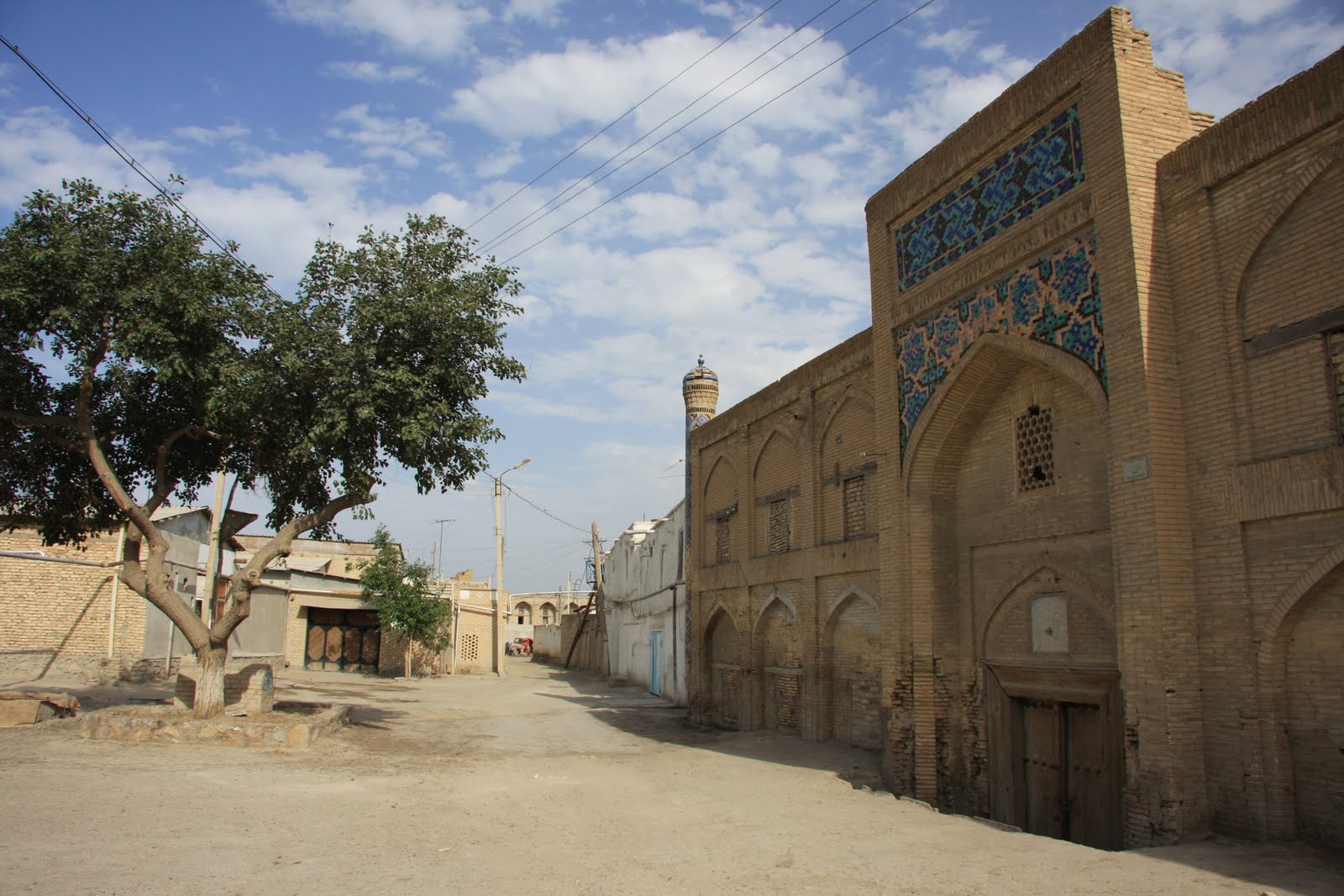
None of Bukhara’s buildings have the grandeur of Samarkand’s Registan or other key sites, yet it feels a more coherent city, with a greater number of historical buildings that remain much more integrated within the city than they are in Samarkand. And while there’s certainly been significant restoration here it too feels less ostentatious and obtrusive than in Samarkand. One of the delights of staying in Bukhara was wandering down the streets of the old town, and coming across an old mosque, medrassah or mausoleum, some restored but most in a state of partial decay, intermingled with the ordinary houses, and which we could explore, invariably as the only people there.


In the centre of the old town is Ark, the city’s ancient fortress. Most of the interior is in ruin, destroyed by the Bolsheviks in 1920, but the great outer walls remain. Since reaching Central Asia, we’ve both been reading about The Great Game, the 19th Century Anglo-Russian struggle from dominance in Central Asia, and so it was particularly interesting to see the Ark, which was the location of one of the most famous episodes. It was there that two British officers and players of the Game, Charles Stoddart and Arthur Connolly (it was Connolly in fact who had coined the phrase “The Great Game”), were held in a vermin infested pit for 2 years by the then Emir before being publicly beheaded and buried somewhere under the square outside the main gate.


We stayed a short walk away near the Lyabi-Hauz pond, the traditional social heart of the city. In the ancient tradition we spent very enjoyable afternoons and evenings sitting by the pond under the shade of the ancient mulberry trees, drinking tea and people watching. Just south of Lyabi-Hauz we were surprised to find a working synagogue and to learn that Bukhara has long had a significant Jewish population, dwindling numbers of whom still remain and continue to speak their own, distinct language, and look like distinctly different from their Uzbek neighbours.

The absence of Bukharan Jews from the official history of the city is just one aspect of the retelling of Uzbek history that has occurred since independence in an effort by the Government to create a shared culture amongst the population in the absence of the USSR and communism. Timur is now heralded as the father of the nation though he was Persian, not Turkic, and his great-grandson Babur was driven out of Samarkand by the Uzbeks. In fact, historically both Samarkand and Bokhara have long been predominantly Tajik cities (Tajiks are closely linked to Persians, and speak a language closely related to Farsi rather than a Turkic language), and most of the population remains Tajik speaking. It’s another reminder of how the region was carved up by the Soviets (and actually by Stalin as Commissar of Nationalities) in a policy of divide and rule to minimise the risk of a pan-Turkism uprising.
It used to be said that there were enough mosques in Bukhara to worship at a different one every day. While this is no longer the case there are still certainly a huge number. Yet while there remain large numbers of religious buildings in the city, and throughout Uzbekistan, we’ve seen little sign of the practice of Islam. This has been noted too by others, with travel writer Colin Thubron suggesting that while there was an initial resurgence of Islam in the early 1990s, bound up with a post-Soviet nationalism, this declined as people became poorer, not richer, in independent Uzbekistan and began to look back more fondly at the Soviet era. Former British Ambassador to Uzbekistan Craig Murray, however, sees a more sinister reason for the apparent decline in Islam, claiming that the government has closed four in five of the country’s mosques, censors the mullahs’ addresses, has banned the call to prayer and discouraged attending prayers and observing Ramadan. Indeed, according to Murray, even possession of the Koran or growing a beard is likely to lead to arrest, detention and torture. Certainly we didn’t hear the call to prayer once in our time in Uzbekistan, despite the profusion of mosques and minarets, and even the working mosques we visited were often entirely deserted.

Most of the sites here operate a rather flexible approach to ticketing. At times it’s been unclear whether the person collecting our entrance money was even officially employed at the monument, while at most sites the price seems to depend on your interest in going in and the number of other tourists around. The concept of opening times also doesn’t seem to exist and we’ve been able to visit several sights early in the morning, or when they were officially closed, by paying the guards direct, enabling us to explore at leisure, the only people around. Inevitably this means that some of our entrance fees have gone direct to the guards and ticket office staff, rather than to the State, yet in a country where official corruption remains endemic and most staff badly paid we felt ok about this.


Khiva

Khiva is the most remote of the Silk Road cities, situated close to the Oxus River and surrounded by the Kyzylkum desert to the east and the Karakum desert to the west,. Whilst this isolation meant a bumpy eight hour car journey for us from Bukhara, its continued remoteness has contributed to ensuring that Khiva is the most complete and intact of the three cities as well as having some of the most homogenous Islamic architecture in all of Central Asia.

Unlike Samarkand and Bukhara, Khiva is a complete fortified city. The Inner City, or Ichon Qala, is wrapped in a one and a half mile belt of city walls, some of which date back to the fifth century. Inside the walls and set around the main street linking the east and west gates are a remarkable collection of original mosques, madressahs, palaces, mausoleums and the town fortress, while to the north and south run a maze of narrow alleyways with small mud brick houses and hammans. Particularly impressive is the Kalta Minor. Commissioned by the Khan in 1852 to stand at over 70 metres high, the biggest in the Islamic world, it was abandoned in the wake of his death at 26 metres. Though not the tallest minaret in Khiva, its great breadth and the glorious head-to-toe tiling mean it dominates the city’s skyline. Elsewhere, in the two palaces, the blue and white tiling was more intricate than we’ve seen anywhere else in the country.


Modern day Khiva feels a world away from descriptions of the town in even the 19th Century. Then, as capital of the Khanate of Khorezm, Khiva was a desert hideout for slave traders, brigands and thieves with a reputation for wanton cruelty, violence and sexual depravation. There were many Russian slaves who had been abducted and sold into slavery in the city, the release of whom became a frequently cited pretext for Russia’s involvement in the Great Game and expansion into Central Asia. Russian men were reportedly the most valuable slaves fetching a price of up to four camels, though Persian women were more sought after than Russian women. Amazingly slavery only ended here in the middle of the nineteenth century.

Khiva was designated a ‘museum-city’ in 1967 by the Soviets, which has led some to describe it as lifeless. However to us it felt very much alive. There are many houses within the city walls, which have apparently been re-occupied following Independence, and immediately outside the walls are a great many more houses as well as a bustling bazaar.


There is a remarkable consistency in the architecture of Samarkand, Bukhara and Khiva. The main mosques and medressahs are fronted by enormous portals, usually decorated with mosaic and tiling but sometimes with frescoes, and surrounded by high walls. At the corners of the compound there are usually minarets, and inside, set around an open-air courtyard, small recessed doorways lead into small, plain cells, which in medrassahs housed the religious students. Above the doorways to each cell there is an arched window, echoing the shape of the main arched doorway, with more decorative tiling above, and at the back of the courtyard is usually a mosque, again fronted by a tiled portal. Many caravanserai we saw also had a similar layout. This consistency of structure is mirrored by a consistency in the colours used in decoration, which is largely limited to deep blue, turquoise and green, with occasional touches of yellow and orange. Yet the buildings are so beautiful, and so varied their decorations that they’re continually absorbing.

Now that the majority are no longer used for worship or study, most of the grand mosques and medrassahs now host tourist stalls selling carpets, ceramics, Soviet memorabilia and other trinkets, as well as the odd restaurant. In Khiva the Mohammed Amin Khan Madrassah – the city’s largest - is now the Hotel Khiva with student cells converted into luxury rooms. We treated ourselves to a night there and loved staying in such a beautiful and historical building. Whilst we were sad that like so many of these ancient buildings, the medrassah is no longer in use, we were glad that at least the cells continued to provide accommodation – albeit to a rather different clientele.

Saturday, 14 May 2011

Uzbekistan: Tashkent and the Fergana Valley

Our first impressions of Uzbekistan were that this was more the Central Asia we expected to find on leaving China: largely gone were the Russian influences and Slavic faces so evident in Kyrgyzstan; instead here the people look more Turkic, like the Uighurs in Western China, and dress more conservatively too. Many of the men wear sombre suit jackets and the older women wear all enveloping velour gowns and headscarves. Unlike in Xinjiang though we’ve seen no women covering their faces, and exposed forearms, ankles and even calves seem entirely acceptable, while gold teeth seem even more popular than they were to the east and it’s rare to see anyone over the age of 40 without a mouth full of shiny metal. We’ve heard little Western, or even Western-style music, since we arrived, with Uzbek, Arabic and Turkish music popular instead. On one bus journey a local girl asked us who our favourite Uzbek pop star was and seemed astonished to hear that people didn’t listen to much Uzbek pop in England.

We crossed into Uzbekistan through the Fergana Valley, the most densely populated area in the country and its industrial and agricultural heartland. Indeed, so fertile and productive is the Valley that when Stalin created the Autonomous Soviet Socialist Republics he divided it between Kyrgyzstan, Uzbekistan and Tajikistan to prevent any single region controlling the Valley and becoming an alternative political and economic power base to Moscow.

The Fergana Valley remains the country’s breadbasket and one of the delights of reaching Uzbekistan for us has been the mass of fresh fruit and vegetables that are sold in every market and most street corners, particularly welcome as in China and Kyrgyzstan we’d struggled to find fresh fruit except for the odd tasteless imported apple. Here most lunchtimes we’ve picnicked on enormous strawberries and tomatoes, delicious cherries, apricots, cucumbers, and wonderful local bread.


Since independence, the Valley has become the centre of Islamic resurgence within Central Asia, and the Uzbek President Karimov has closed many of the mosques and cracked down on opposition in the Valley in the name of the War on Terror. As a result, parts of the Valley have a reputation for conservative extremism and xenophobia, yet as elsewhere in the country we were welcomed both at mosques and elsewhere with curiosity and warmth.


Though we’ve been on the Silk Road now for over a month, before reaching the Fergana Valley we’d seen no sign of any silk. In the Valley and throughout Uzbekistan however many of the women wear long silk gowns in the traditional (and to our eyes rather garish) atlas design, and the Valley is also the centre of silk production in Uzbekistan. While there we visited a small factory where all production is carried out by hand – from rearing the silk worms on fresh mulberry leaves, to boiling their cocoons and extracting the thread, to dyeing and weaving.


Tashkent, the Uzbek capital, is a pleasant city. Much more visually interesting than Bishkek, the centre consists of a collection of grand new and colonial buildings set around wide, tree-lined avenues and beautifully designed and maintained gardens. Many of the old Soviet-era housing blocks are decorated with mosaics and murals, and the metro stations are beautiful: a mix of grand marble and art deco designs. Yet though the area around the farmers market buzzes with life, most of the city felt rather lifeless, and the collection of central museums were very underwhelming.


Travelling in Uzbekistan we’ve also been continually reminded that we’re back in an authoritarian state. There are police everywhere, and each time we travelled on the metro in Tashkent we were searched and asked for our passports, while we had to pass through frequent, lengthy police checks on the drive from Fergana to Tashkent. Unlike in Kyrgyzstan, where one of the highlights for us was staying with locals, here foreigners must stay in hotels licensed to take non-Uzbeks and be registered with the security services. Yet though this has at times proved irritating, we foreigners get off lightly compared to Uzbeks who apparently face continual low level police harassment and demands for bribes and are forced to work for free in the country’s cotton fields for two months every year, while the State’s human rights and torture record is one of the worst on the planet.

Friday, 6 May 2011

Bishkek and Osh

In the same way that many of Kyrgyzstan’s cities and towns feel like large villages, Bishkek seems more like a laid-back provisional town than a capital city. It’s a mix of low-rise Soviet-era housing and large 1960s modernist concrete municipal buildings, very much from the
same school of design as the pre-renovation London South Bank Centre. These could have felt a little drab if it weren’t for the abundance of parks, large public squares, and wide leafy roads, all of which seemed popular and well used. The permanently snow capped Ala-Too mountains visible from the city centre provide a magnificent backdrop.

Most people, us included, visit Kyrgyzstan for the amazing natural beauty of the landscape not the cities and whilst there are few “must see” attractions Bishkek was a pleasant place to spend a few days while we waited for visas. One of our highlights was the afternoon we spent relaxing in the luxurious Russian banya – still evidently a popular feature of daily life. Essentially a large bathhouse with
sauna and an ice cold splash pool, we joined locals as they sweated it out, scrubbed their skin to within a inch of its life and beat themselves with bundles of oak leaves, all stark naked except in some cases for, bizarrely, a traditional Kyrgyz tall white felt hat. We also feasted on the first international cuisine we’d found since Nepal and enjoyed the few swanky bars and restaurants frequented by expats
and NGO workers and made the most of some draft cider we found.


However, despite being the most cosmopolitan city we’ve visited for some time there’s still evident poverty, with careworn buildings, unpaved roads, open drains, and people collecting water from standpipes and suffering the effects of years of hard vodka drinking. There are few shops in the capital and most food and clothes shopping still seems to take place in the bazaar, with those corner shops we found poorly stocked, except for a vast array of alcohol. GDP too is still very low, at just $941 per year per capita, the equivalent of around £1,600 given lower local prices. Corruption, both large and small scale, is also reportedly a real issue, although thankfully we didn’t experience any.


From Bishkek we travelled to Osh, Kyrgyzstan’s second largest city which is located in the south of the country. The Ala-Too mountains effectively divide the northern and the southern parts of the country, especially in winter when snow closes the mountain passes, with the South generally poorer, more Islamic and ethnically mixed than the more Russified North.

The journey from north to south was visually stunning: the road wound up and down several mountain passes above 3,500m before opening out to pasture land with yurts set up for summer grazing and vast herds of animals that seemed to enjoy wandering over the road at regular intervals. We travelled by shared taxi, as we have throughout Kyrgyzstan. Much faster than buses and minibuses, shared taxis run set
routes between cities, charge by the seat and generally drive without stopping making them an exceptionally convenient and fast – although occasionally hair-raising – method of transport. “Highlights” on this journey included the handbrake failing on a steep hill when the driver got out to pour more water into the overheated engine and his continual overtaking on blind corners while simultaneously smoking and texting!


Osh is only 5km away from the Uzbekistan border, is partly surrounded by Uzbek territory, and has a large (40%) Uzbek population. Ethnic tension between Uzbeks (who tend to be wealthier) and Kyrgyz in Osh has been a frequent cause of strife, most recently in June 2010 when riots broke out and an estimated 200 to 2000 people were killed. Even now we were repeatedly warned by locals not to go out at dark as the threat of violence was still high. During the day however we felt no obvious tension. On the Sunday we spent there the parks were filled with families and mixed Uzbek and Kyrgyz groups enjoying the sunshine and the people we spoke to were keen to stress the friendship between the two.

Thursday, 28 April 2011

Lake Issy-Kul and the Tien Shan Mountains

Kyrgyzstan feels much further than it actually is from China. Chinese faces, food, architecture, chopsticks and culture all vanished as we crossed the mountains into the Kyrgyz steppe. Instead the Soviet legacy is immediately apparent and Kyrgyzstan is a fascinating blend of Russian and Central Asian influences. In the northern towns there are as many Slavic faces as there are Mongoloid and Central Asian; tracksuits and trainers are as common as headscarves; battered ladas compete for space on the roads with herdsmen on horseback; Lenin statues continue to stand proudly over central squares; the food is a combination of shashlik, noodles, borscht and mashed potatoes, with weights as well as prices listed on every menu just as in Russia, and the first leavened bread we’ve seen since Moscow. The streets are a mixture of mud brick houses, Siberian style wooden cottages and monstrous dilapidated Soviet blocks of flats. Both Russian and Kyrgyz are widely spoken, with both written in Cyrillic script, and while Islam is the dominant religion here it seems less strictly adhered to than it is in Western China (drinking certainly plays a larger role here in social customs), and Russian Orthodox churches as well as mosques are visible in the towns. This Russian influence, and the use of an alphabet that we can read, even if not understand, gives Kyrgyzstan a much more familiar feel than anywhere we’ve been for some time, and at times has us almost believing we’re back on the eastern fringes of Europe.

We spent a few days in Karakol, a sleepy, slightly run down provisional capital on the edge of the Tien Shan mountains in the north east of the country near the Kazakh border. Karakol has an interesting animal market and beautiful old wooden Russian Orthodox church and faded wooden houses, but it's hard to believe walking around its quiet streets that it's a provincial capital. In season apparently the town is filled with tourists, primarily Russians and Kazakhs, drawn in winter by the opportunities to ski and in summer to trek and climb. In late April though the town felt almost deserted.

South of the town, the mountains rise dramatically above the plain. Climbing up into them we found a beautiful landscape utterly unlike the open grassland we’d ridden through in the centre of the country. Here we walked through narrow Alpine valleys, passing stretches of pine forest and open meadows. The higher passes remained closed by snow and even in these lower valleys patches of snow remained, yet through the grass wild violets, and crocuses miniature pansies were appearing.


For much of this year we’ve felt disconnected from the seasons, avoiding autumn by travelling east through a perpetual Indian Summer and then skipping winter in the tropics of South East Asia. Finally it feels like spring is here and we’re back in step with the seasons as we expect them. In the mountains we walked to close to the snow line, camped out in an open meadow near a rushing river of icy water and bathed in natural hot springs.


Throughout our trip we’ve come across repeated references to some of the great 19th Century European explorers of Asia. We heard of Nikolai Przewalski first in Mongolia, where the wild horses there bear his name, and then again in Tibet where we was one of the first Europeans to explore the country and came close to becoming the first European to reach Lhasa. Between 1867 and 1885 he travelled through much of Central Asia, China, Mongolia and Tibet, mapping huge areas and collecting vast numbers of plant, animal and bird specimens. On the eve of his fifth expedition he died near Karakol and for a while the town was named in his honour, and there remains a small monument to him and a fascinating museum recording his achievements.

Just north of Karakol, stretching west for 170 km lies Lake Issyk-Kul, the second largest alpine lake in the world after Lake Titicaca in South America. Unlike Central Kyrgyzstan, much of the land around the lake is cultivated and from its shores to the foothills of the Tien Shan to the north stretch fields edged with lines of poplars. In Soviet days, spa resorts lined the shores of Issyk-Kul. Most have now closed, although a ribbon of rather run-down houses and cafes still lines the main road around the shore. About midway along the northern shore of the lake lies Cholpon Ata, a small non-descript town where we spent a couple of relaxing days.

Just outside the town we visited a field strewn with glacial boulders decorated between the 8th Century BC and the 1st Century AD with paintings of goats, sheep, camels and hunting scenes. Unfortunately it started raining as we arrived, and most of the petroglyphs are unmarked so we spent an hour or so trying to spot the drawings – some are amazingly well preserved but others almost indistinguishable from the marks of rain or lichen – and then headed sodden back to town.

Cholpon-Ata’s main attractions are its beaches and lakeside setting. Like much of urban and semi-urban Kyrgyzstan, the area around the beach looked shabby and neglected, with a collection of half-finished buildings, overgrown bushes, derelict trailers and rubbish. Even the sanatorium, which in its heyday apparently used to attract the elite of the Communist Party, looked rundown and shut up. Yet the lakeside itself was still stunningly beautiful: the white sand and impossibly clear water both sparkled in the sunshine, and across the lake the snow-capped mountains to the south were just visible. Issyk-kul means “hot lake” in Kyrgyz, for a combination of extreme depth, thermal activity and high salinity means that remarkably the lake never freezes and instead has a moderating effect on the local climate. “Hot” though was overstating it on the day we spent on the beach, and only Rachael braved the icy water, while Kieran opted to lie on the beach and sunbathe.

Central Kyrgyzstan

We crossed into Kyrgyzstan through a dramatic high mountain pass used by Silk Road traders for centuries, but which is now officially closed to non-local traffic. In practice this just meant that we had to hire private transport both sides of the border and arrange various permits, but ensured that other than a handful of trucks we were the only people crossing that day.

The landscape on the Chinese side of the border was harsh and dramatic, with bare sandstone cliffs of bright reds, yellows and purples rising out of the dry valley. The mountains act as a watershed, separating the desert on the east from the high grasslands to the west, and as we crossed the Torugart Pass the scenery changed instantly. Near the Pass the ground was thickly covered in snow, and then as we descended and the snow melted we could see the crumpled hills were covered in grass, giving them a softer, gentler appearance. The road changed too at the border, the newly asphalted Chinese surface giving way to a potholed dirt track.

We spent our first night in Kyrgyzstan close to a thousand year old caravanserai, in the home of the site’s caretaker. The caravanserai, Tash Rabat, is a beautiful dark stone building with rounded towers and a high dome roof that’s half sunk into the hillside in a hidden valley away from the main trail. We were the only people there and in solitude in the late afternoon light we explored its cold damp central chamber, dark passageways and platformed side sleeping chambers that would once have provided shelter for Silk Road traders and their animals.


We were met at Tash Rabat by Dzakshylyck who brought horses with him and for the next two days was to be our guide as we rode across the steppe. Undoubtedly one of the highlights of our whole trip, we rode under cloudless blue skies across some of the most beautiful countryside imaginable, through wide open grassy valleys that rose to crumpled hills and snowy mountains at their edges. For almost the whole of the first day we saw only a handful of herdsmen, also on horseback, all wearing the traditional Kyrgyz white felt hats that resemble miniature yurts. At times the only sounds were the squawks of marmots calling out a warning before they vanished into their burrows.

On the second day we passed increasing signs of human activity and habitation, yet continued to be struck by the emptiness of the landscape, and the enormous sense of space that there is here. There are few villages or even isolated houses in the huge open steppe, and the weather is still too cold for the nomads and shepherds to have set up their yurts in the open pasture. Even the towns look more like villages, with low-rise, detached houses spread thinly along wide streets, with room for animals to graze around each building, for the country’s five million inhabitants are vastly outnumbered by their livestock.


The riding itself was fantastic. Our horses were smaller than most in the UK yet significantly larger than the Mongolian horses we’d ridden and very sprightly, breaking easily into a canter when we urged them on, and easily jumping the ditches that streaked across our path. Neither of us had ever ridden before for seven hours a day though, and certainly not sitting on wooden saddles, so by the end of two days we were feeling slightly stiff and sore and were both sorry and slightly relieved to finish.


We spent our second night in Dzakshylyck’s house, and were again humbled by the Kyrgyz hospitality and generosity which have been a feature of our time in Kyrgyzstan so far. From the moment we arrived his wife and older daughter plied us with tea and food and the entire family went out of their way to welcome us and look after us. Tea is served differently here from anywhere else we’ve been: it’s milky for the first time since Nepal and Tibet, and poured by mixing a small amount of strong luke warm black tea from one pot with hot water from another. Served in small bowls by the woman of the house, bowls are refilled so frequently the hostess rarely seems to get a chance to drink her own tea.

Almost every night so far in Kyrgyzstan we have stayed with a family, often on a bed of sheep skin rugs and blankets made up on the floor, with carpets rather than pictures hung on the walls for decoration. Although lacking in privacy these homestays have been wonderful and a real highlight of our time here – providing a comfortable place to sleep, a warm welcome (far warmer than is offered at the old Soviet-style hotels which are the alternative accommodation), good food and a fascinating insight into what life here can be like.

Sunday, 24 April 2011

Western China

China’s westernmost province is ethnically, culturally and linguistically unlike anywhere else we’ve visited in the country. Named Xinjiang, or “new frontier” by the Chinese, and traditionally known as East Turkestan in the West, the region was under Chinese control between the First Century BC and the Ninth Century AD but was then ruled separately from the rest of China (and either independent or under Mongol rule) for over a thousand years, and still feels very separate from the rest of China.

Getting off the train from Xian, and throughout our time in Xinjiang, we had to keep reminding ourselves we were still in China, so different does it feel to the rest of the country. The landscape is dry and desert-like and very unlike the lush fertile east; the older buildings tend to be single storey and built of mud bricks while the newer ones are built in Arabian rather than Chinese style; the local Uighur language sounds guttural and entirely different from Chinese, and there’s relatively little Chinese script visible too, with Uighur instead written using a modified Arabic script; the music sounds Turkish or Middle Eastern; the food is different; and above all the people look and dress very differently.


In Xinjiang noodles and flat breads (called naan) rather than rice are the staple foods. Both are delicious, the bread topped with sesame or poppy seeds and the noodles pulled by hand into long threads and served with spicy sauces of tomatoes, onions, peppers and mutton. The streets are filled with the smells of bread cooking in outdoor tandoor ovens, and of burning charcoal and grilled mutton rising from the road-side kebab stalls. The tea is different too – it’s still predominantly green tea that’s served but which is flavoured with rose petals or spices and served in bowls rather than cups.


The local population is predominantly Uighur (a people of Turkic origin), with a mix of ethnic Tajiks, Kyrgyz and Kazaks as well, and facially people look Central Asian rather than Chinese. Both men and women tend to dress relatively conservatively, the men in dark suits and the women in drab coloured long skirts and coats with covered heads (often the headscarves are the one flash of colour in their outfits). Here for the first time in China we saw women with covered faces too, but wearing not delicate veils or even burkhas but thick brown cloths just draped over their faces like a tea towel. The men too cover their heads with hats of varying styles, with flat caps and diamond-shaped green embroidered hats the most popular. Under their hats most of the older men have shaved or short cropped hair but sport long flowing beards (with shaved upper lips), while the younger and middle-aged men tend to have moustaches but no beards.

Despite their outwardly conservative appearance however we found the Uighurs overwhelmingly and immediately friendly and hospitable, in contrast to the majority of the Han Chinese we’d met elsewhere in China. Almost everywhere we were greeted with warmth, kindness and curiosity, with people intrigued as to who we were, where we were from and what had brought us to their province and keen to welcome us. Surprisingly too although the region sees far fewer tourists than other parts of China, we met far more people in Xinjiang who could or chose to talk to us in English. Sadly though, as in Tibet, several of the Uighurs we spoke to told us of how their culture and religion are being repressed and of how they face discrimination even in their homeland with the best jobs reserved for influx of Han Chinese the Government are attracting to the region with generous tax breaks.


We broke our journey from Xian to the West of Xinjiang in a small town called Turpan, famous in China for being both the lowest place in the country (at 154 metres below sea level) and the hottest (with a highest recorded temperature of 49.6 degrees), as well as being pretty much the furthest place in the world from the sea. Thankfully it wasn’t too hot when we were there and we spent an interesting and enjoyable day exploring a traditional mud-brick built Uighur village in the desert, the ruins of a 14th Century Han Garrison city, and Turpan’s sprawling bazaar.


From Turpan we travelled on to Kashgar, a town of narrow lanes and small ornate mosques in the far west of the province which is famous for holding one of the largest animal markets in Central Asia. From early morning, the market place filled up steadily with livestock and men: bulls, sheep, donkeys, and even a few dogs, cats and horses were hustled off carts and trucks and tethered to the dusty ground, while groups of men mingled around them. Later we visited another, even more chaotic market in a neighbouring small town where alongside the animals we’d seen traded in Kashgar was a surprisingly large camel market, complete with babies as well as adult camels –apparently a healthy adult camel sells for around £1000.


From Kashgar we spent a few days travelling south along the Karakorum Highway which cuts through the Pamirs and Karakorum mountain ranges to connect Kashgar and Islamabad. The road runs through high, desert like country, at times cutting through deep and narrow gorges, and at others crossing wide open boulder strewn plains and passing enormous frozen lakes. At all times the mountains dominated the views, their lower sections an amazing array of soft pastel colours with thick snow and ice above.


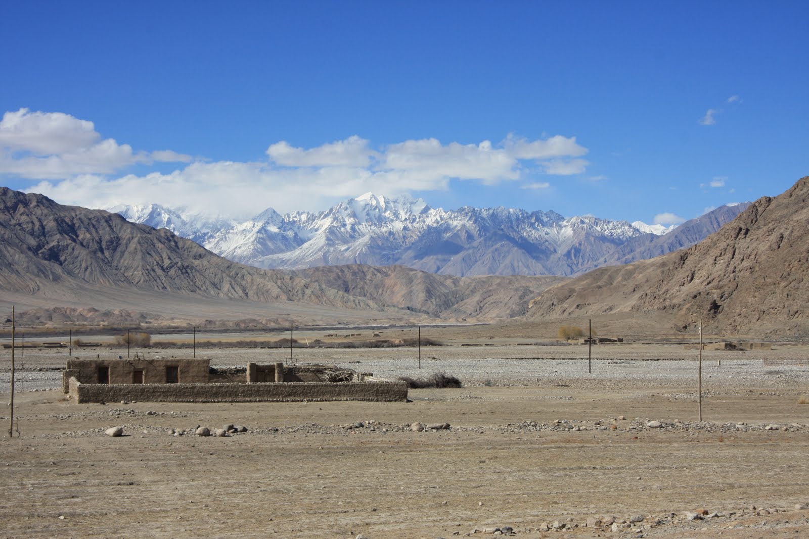
We spent two days in Tashkurgan, a small Tajik town close to the Tajikistan, Pakistan and Afghanistan borders, going for walks out across the plains, past shepherds and their huge flocks of sheep. Here we saw few cars, with most families owning a donkey and cart which forms their main form of transport. At a small village nestled at the foot of the hills a couple invited us into their home and served us bread and tea, humbling us with their generous hospitality. Lacking any shared language we communicated through mime and played with their two year old twins who soon got over their shock at having two odd looking strangers in their house. Their home was immaculately neat and tidy but almost entirely lacking in possessions: in the main room where we ate there were just a small stove, a foot-powered sewing machine and a collection of rugs and blankets. Amazingly, most of the people in the village seemed to speak not only no Chinese, but also no Uighur (the predominant language of the region), only Tajik, giving an indication of how localised their worlds must be. As in Mongolia, the sheer scale of the landscape with its wide open spaces and bright blue skies was incredible, and its colours and beauty wonderfully restorative.


Before leaving China we spent two days camel riding and camping out in the vast Taklamakan Desert, one of the largest sandy deserts in the world which covers an area of 270,000 square kilometres and was recently crossed on foot for the first time in 72 days. Although we ventured only a short way into the desert we soon felt disorientated and lost in the midst of high, shifting sand-dunes that stretched to the horizon with – to our eyes – no discernable landmarks. As elsewhere in Xinjiang we were struck by the vastness of the landscape and by the quiet that engulfs it: we saw no other people nor any sign of them while we were in the desert, there are no settlements there, and just a handful of wandering shepherds and occasional tourists, and a sense of great emptiness.


Just being in the desert was a wonderful experience, while the camel riding itself was also hugely enjoyable, with the motion of the animals similar to being on a gently rocking boat and familiar to us from our camel riding in Mongolia. Where that had been on flat stable ground however this time the animals had to clamber up and down unstable sand-dunes that looked just like the deserts of our imaginations.

Our ten days in Xinjiang have been a highlight of all of our time in China. Yet we would probably never have come to this beautiful and fascinating area if we hadn’t intended to travel on into Central Asia. It is an area about which remains relatively unknown in the West and of which we were largely ignorant before researching our route: though it occupies a sixth of China’s landmass it receives few foreign tourists, rarely features in the media and the chapter on Xinjiang was one of the shortest in our guidebook. Yet it is one of the most interesting, varied and beautiful places we’ve visited not just in China but anywhere and deserves to be considered as a destination in its own right.